THINGS TO DO
Hike in Biogradska Gora
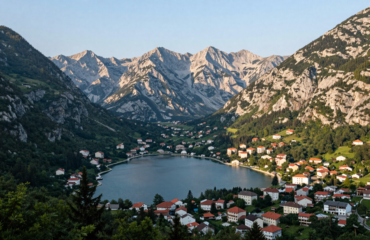
Walk the trail around Biogradsko Lake and into the primeval forest of Biogradska Gora National Park — one of Europe’s rarest old-growth woods, with a glacial lake at its heart.

Kolašin is a mountain town at 954 m on the Bjelasica range, the gateway to Biogradska Gora National Park — one of Europe’s last tracts of primeval forest, with a glacial lake at its heart. A winter ski resort and summer hiking base, it sits on the road between Podgorica and the north, at the head of the Morača corridor that climbs from the coast through canyon country to the highlands. From the town, Biogradska Gora’s old-growth forest and Bjelasica’s rounded peaks rise to the east, while the katun summer pastures above the tree line and the Morača Monastery downstream place Kolašin at a crossroads of protected nature, highland life and medieval faith. Plan two to three days: one for the primeval forest and Biogradsko Lake, a second for the Bjelasica peaks and katun landscapes, and a third for the Morača canyon and monastery — all of it weather-, season- and access-dependent.
MAP & LOCATION
THROUGH THE LENS


HISTORY & CULTURE
Kolašin was founded in the 17th century and developed as a small mountain town on the route between the coast and the northern Sandžak, later a frontline in Montenegro’s wars with the Ottomans and the site of heavy fighting in both world wars. Biogradska Gora was protected as early as 1878, when it was given to the people of Kolašin by Prince Nikola, and became a national park in 1952 — one of the oldest protected areas in the Balkans. The Bjelasica range, with its rounded peaks and high katun pastures, has shaped highland life around seasonal transhumance for centuries, while the Morača corridor downstream carries the medieval Morača Monastery, founded in 1252, linking Kolašin’s mountain world to the canyon country between the highlands and the coast.
TOP THINGS TO DO
TOP ATTRACTIONS
FOOD & DRINK
Konoba Lupo — mountain dishes in the town centre
Mali Sir — cheese and dairy from the Bjelasica katuns
Savardak — traditional katun cooking above the tree line when open in season
HOTELS & STAYS
Hotel Bianca — a resort and spa base in Kolašin
Brile Hotel — a modern town-centre hotel close to the ski lifts
Eko Katun Nevidio — highland katun accommodation on the Bjelasica slopes, seasonal
Routes
A three-day editorial touring sequence across Northern Montenegro — from Kolašin and Biogradska Gora to the Tara canyon and Đurđevića Tara Bridge, on to Žabljak and Durmitor, and finally over the Sedlo pass and Trsa to the Piva canyon and Plužine.
3 days · challenging
VIEW ROUTEA two-day editorial touring sequence across Montenegro’s eastern highlands — from Kolašin and Biogradska Gora’s primeval forest, via the Andrijevica corridor, to Plav Lake, the multi-community town of Gusinje, the Ali Pasha Springs and the Grebaje Valley beneath the Karanfili peaks.
2 days · challenging
VIEW ROUTEPLAN YOUR VISIT
Kolašin is on the main road and rail line between Podgorica and the north; trains and buses run along the Morača corridor, though services are limited and seasonal, and the road climbs through narrow, winding canyon sections that can be slow and are hazardous in winter weather. The nearest airport is Podgorica, about 80 km to the south.
The town is walkable, but reaching Biogradsko Lake, the Bjelasica trailheads, the ski lifts and the Morača Monastery needs a car or arranged transport; mountain roads are narrow, unlit and poorly marked in places, parking is limited at popular trailheads, and public transport does not serve the higher routes.
June to September for hiking and the forest at its greenest; January to March for skiing. Snow can linger on the high ground into late spring and return by autumn, fog and storms build quickly year-round, and mobile coverage is patchy to absent in the park and on the forest roads — check the forecast, carry an offline map and do not rely on a phone signal.
Sturdy footwear, warm and waterproof layers, sun protection, water and snacks, an offline map and a charged phone torch. For the higher Bjelasica trails add a proper map, extra insulation and a first-aid kit; for winter visits add full snow gear, and never assume ski lifts, trails or viewpoints are open without checking first.
The town centre is generally accessible, but Biogradsko Lake and the Bjelasica trailheads are reached by narrow mountain roads with limited or no designated parking, and most trails are uneven, unpaved and unsuitable for wheelchairs or limited mobility. The Morača Monastery sits on a steep canyon site with steps and uneven ground. Facilities, signage and assistance are limited — confirm access locally before setting out.
NEARBY ESSENTIALS
Practical services and stops along the way — fuel, food, parking, campsites, medical and motorcycle services. Listings are compiled from published sources; confirm current opening dates, prices and facilities directly with each operator.
Tourist Organisation Kolašin
0 mVisitor Information
Official visitor-information office for Kolašin. Confirm current office hours, Biogradska Gora and Bjelasica access, transport, trail conditions and seasonal services directly before travelling.
Sources checked: 7 Oct 2026
Camp Lipovo
Campsite
Small camp in the Lipovo Valley near Kolašin. Confirm opening dates, space for tents and campervans, electricity, sanitation, meals and vehicle suitability directly before travelling.
Sources checked: 7 Oct 2026
WEATHER
Forecast data from Open-Meteo. Updated regularly.
TRAVEL GUIDES · STORIES
More here soon — the road is still being mapped.
NEARBY DESTINATIONS
INTERESTS
REGIONS
COUNTRIES
MORE TO EXPLORE
The atlas goes on — more destinations, stories and road trips from every corner of the world.