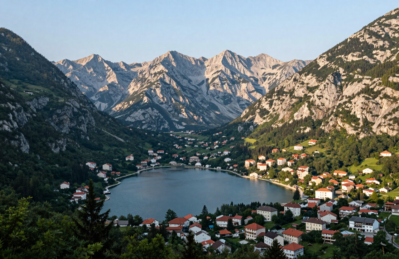
Žabljak, Montenegro, a small mountain town on the Durmitor plateau surrounded by pine forests and limestone peaks

Nature & Hiking

Žabljak

Montenegro’s mountain capital on the Durmitor plateau.

Plan my trip

QUICK INFORMATION

COUNTRY
Montenegro
REGION
Durmitor & Northern Mountains
BEST TIME TO VISIT
June to September for hiking and the lakes
DURATION
2–3 days

ABOUT THE DESTINATION

Žabljak is Montenegro’s highest town at 1,456 m, the gateway to Durmitor National Park — a massif of 48 limestone peaks above 2,000 m, 18 glacial lakes and the deep canyon of the Tara river. A former mining and forestry settlement, it is now the country’s principal centre for hiking, winter sports and canyon adventures.

HISTORY & CULTURE

The Story Behind the Place

Žabljak developed as a small trading and forestry settlement on the high Durmitor plateau, growing into a modest resort from the 20th century as Montenegrins discovered the mountains for recreation. Durmitor National Park was established in 1952 and inscribed on the UNESCO World Heritage List in 1980, putting Žabljak on the map as the gateway town.

TOP ATTRACTIONS

Sights & Highlights of Žabljak

FOOD & DRINK

WHERE TO EAT

01

Savardak — traditional Durmitor dishes near the town

02

Pizzeria Durmitor — a practical town-centre staple

03

Mountain guesthouse kitchens — hearty soups, grilled meats, dairy dishes and other highland food around Žabljak

HOTELS & STAYS

WHERE TO STAY

01

Hotel Polar Star — modern rooms in town

02

Eko Katun H2O — mountain huts on the plateau

03

Family-run chalets and apartments — flexible self-catering bases in and around Žabljak

Routes

Routes & rides

scenic-road

Durmitor Ring and Piva Canyon — Žabljak to Plužine

A one-way scenic mountain traverse from Žabljak across the Jezerska plateau, Sedlo pass and Trsa to the Piva canyon and Plužine — the high-country half of the Durmitor Ring rather than the complete circuit.

1 days · challenging

VIEW ROUTE
scenic-road

The Complete Durmitor Ring — Žabljak, Sedlo, Piva Canyon and Šavnik

The full circular drive around the Durmitor massif — from Žabljak over the Jezerska plateau and the Sedlo pass to Trsa and Plužine, along the Piva lake shore, then back east through Šavnik to close the loop.

1 days · challenging

VIEW ROUTE
campervan

Durmitor Ring by Campervan — RV Guide to the Full Circuit

The complete Durmitor Ring planned for campervans and RVs — the same Žabljak–Sedlo–Plužine–Piva–Šavnik circuit, read through a campervan lens: turnaround reality, fuel, overnights, season and narrow-section cautions.

2 days · challenging

VIEW ROUTE
road-trip

Northern Montenegro Grand Tour — Kolašin, Tara, Durmitor and Piva

A three-day editorial touring sequence across Northern Montenegro — from Kolašin and Biogradska Gora to the Tara canyon and Đurđevića Tara Bridge, on to Žabljak and Durmitor, and finally over the Sedlo pass and Trsa to the Piva canyon and Plužine.

3 days · challenging

VIEW ROUTE
hiking

Bobotov Kuk from Sedlo — Durmitor Summit Route

A serious circular summit day on the Durmitor massif from the Sedlo pass, via Zeleni Vir, to Bobotov Kuk (2,523 m) and back — alpine terrain, scrambling, exposure and fixed cables for properly equipped and experienced hikers.

9.5 km · 7 h · challenging

VIEW ROUTE
cycling

Durmitor Ring Cycling Circuit — Žabljak, Trsa and Sušica

A challenging full-day road-cycling circuit of the Durmitor ring road from Žabljak, over Mala Crna Gora and Nedajno to Trsa, and back through Pišče and the Sušica valley — active mountain roads, long climbs and descents for experienced, self-sufficient cyclists.

76 km · challenging

VIEW ROUTE

PLAN YOUR VISIT

Practical Information

Getting There

Žabljak is reached by road from Podgorica (about 2.5 hours via Šavnik), from the coast via the Đurđevića Tara Bridge, or from Serbia via Prijepolje; the mountain roads are narrow and seasonal, and some passes may be closed by snow in winter. A seasonal bus service connects Žabljak with Podgorica, Nikšić and other Montenegrin towns, but services are limited and reduce outside summer — check current timetables and do not rely on public transport to reach the dispersed mountain sites.

Getting Around

The town itself is walkable, but the dispersed sites around Durmitor — Black Lake, Sedlo, the Ćurevac viewpoint, the Vražje and Riblje lakes, and the Đurđevića Tara Bridge — are separate locations reached by road. Separate transport (a vehicle or verified local transport) is needed to move between them; the five-stop day is not one continuous walking route.

When to Go

June to September for hiking, the lakes and the high passes, when the high trails are most likely clear of snow; January to March for winter sports. Rafting runs from spring to early autumn. Outside summer, high passes and plateau roads may be closed by snow and access to the dispersed sites is not guaranteed.

What to Wear & Bring

Mountain weather changes rapidly — carry grip footwear, warm layers, waterproofs, water, sun protection and an offline map, even on short walks. Snow and ice can persist on high trails and shaded sections well into summer; carry a phone torch and plan for limited mobile coverage on the high plateaus. Plan ahead for emergencies, including how to call for help and where the nearest services are.

Accessibility & Mobility

The town of Žabljak and selected lower viewpoints, including the flat Black Lake loop, are accessible to many visitors, but the rough mountain trails, steep summit routes such as Bobotov Kuk, uneven lake paths and exposed canyon-rim viewpoints like Ćurevac are not step-free and are unsuitable for visitors with mobility difficulties. Many sites have no maintained barriers, paths or facilities — assess each location against current conditions and your own abilities, and do not assume step-free access anywhere outside the town.
NEARBY ESSENTIALS

Services & practical stops nearby

Practical services and stops along the way — fuel, food, parking, campsites, medical and motorcycle services. Listings are compiled from published sources; confirm current opening dates, prices and facilities directly with each operator.

  • Tourist Organisation Žabljak

    0 m

    Visitor Information

    Official visitor-information office for Žabljak and the surrounding Durmitor area. Confirm current office hours, Durmitor and Tara road and trail conditions, park access, guided services, weather and seasonal services directly before travelling.

    Sources checked: 7 Oct 2026

  • Auto Camp Mlinski Potok

    Campsite

    Mountain campsite near Black Lake outside Žabljak. Confirm seasonal opening, pitch availability, vehicle access, electricity, sanitation, fire rules and booking directly before travelling.

    Sources checked: 7 Oct 2026

WEATHER

Žabljak — Current conditions & forecast

Forecast data from Open-Meteo. Updated regularly.

TRAVEL GUIDES · STORIES

More here soon — the road is still being mapped.

All stories

NEARBY DESTINATIONS

Continue the Journey

MORE TO EXPLORE

Keep exploring

The atlas goes on — more destinations, stories and road trips from every corner of the world.