Durmitor & Northern Mountains, Montenegro — REGION GUIDE

REGION GUIDE

DURMITOR & NORTHERN MOUNTAINS

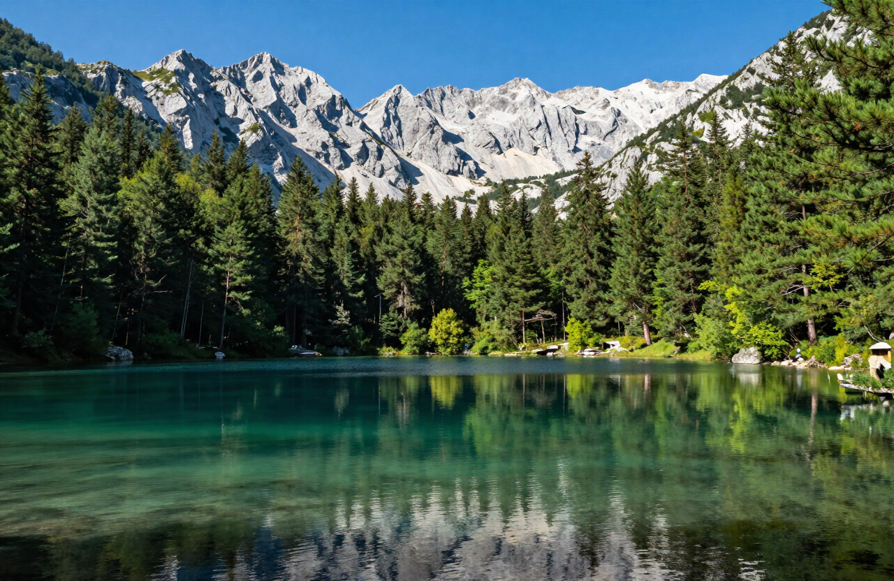
Montenegro’s high northern interior — Durmitor and Žabljak above the Tara Canyon, the Biogradska Gora rainforest around Kolašin, the Piva reservoir and canyon country above Plužine, and the remote Prokletije peaks above Plav and Gusinje — a broad editorial mountain region rather than one compact circuit or administrative unit.

SCROLL
Detailed coverage

Durmitor & Northern Mountains — This region now includes detailed destination guides, routes, campsites and practical outdoor information.

ABOUT THE REGION

The region at a glance

Durmitor & Northern Mountains is a broad editorial mountain region that gathers five separate destinations across Montenegro’s high interior, not a single compact circuit or administrative unit. In the west, Žabljak sits as the principal gateway to Durmitor National Park — its glacial lakes, high pastures and the Black Pine forests that climb toward Bobotov Kuv — and to the dramatic gorge of the Tara Canyon, with the Đurđevića Tara bridge and canyon viewpoints forming a separate destination in their own right. South-west of Žabljak, Plužine & Piva opens a different landscape entirely: the deep artificial reservoir of Piva Lake, the relocated Piva Monastery, the canyon of the river Piva and the dispersed mountain villages of Piva Nature Park, all reached through long tunnels and narrow canyon roads. To the east, Kolašin anchors the Biogradska Gora National Park and its primeval rainforest around Biogradsko Lake, with the Bjelasica mountain and katun landscapes rising above the town. Still farther east, Plav, Gusinje & Prokletije reaches the country’s most remote border mountains — Plav Lake, the historic Gusinje town, the Ali Pasha Springs, the Grebaje and Ropojana valleys and the karst spring lake of Oko Skakavice beneath the Karanfili peaks of the Prokletije range. These five destinations are separated by long mountain transfers, high passes, seasonal roads and very different terrain, and they should never be presented as one walkable or quick-driving cluster. The region is best read as a western section (Durmitor, Tara Canyon and Piva) and an eastern section (Kolašin, Biogradska Gora and Prokletije), each needing its own base and additional time, with the connection between them planned as a proper mountain journey rather than a short hop.

QUICK INFORMATION

COUNTRY
Montenegro
DESTINATIONS
5
REGIONS
Durmitor & Northern Mountains

PLAN THE REGION

Plan Durmitor & Northern Mountains

BEST TIME TO VISIT

Late spring through early autumn (roughly June–September) is the main accessible season, when the high passes are most likely to be open, the lakes are free of ice and the mountain trails are most usable. Summer brings the fullest visitor life but also afternoon thunderstorms, heat in the lower valleys and significant exposure on the high ridges. Autumn colours the forests and softens the light but shortens the daylight and brings cold nights. Winter offers deep snow, ice, avalanche risk and short days, with many high roads, passes and trails closed or impractical; winter travel is for properly equipped, experienced visitors and is not a general sightseeing season. Spring can bring lingering snow, mud and swollen streams on the higher routes. No pass, trail, road, refuge, lift, boat or facility is guaranteed open at any time — mountain weather changes quickly at altitude, and current conditions must be checked directly before every high or long outing.

RECOMMENDED DURATION

Approximately 5–8 days. The region’s western and eastern sections need separate bases and additional time, and cannot be compressed into a single short loop. A focused western introduction of two to three days can cover Žabljak and the Tara Canyon gateway with a selected Durmitor stop, or extend to Plužine & Piva as a separate canyon-country day. A separate eastern block of three to four days covers Kolašin and Biogradska Gora and then the long transfer to Plav, Gusinje and Prokletije. Attempting all five destinations in fewer than five days produces long driving days and little time on the ground; a full week to eight days allows the two sections to be taken at a realistic pace with weather flexibility and proper mountain-outing time. No duration guarantees that any pass, trail, refuge, boat or facility is open — confirm current conditions throughout.

GETTING AROUND

A private vehicle is the practical way to move between these dispersed mountain destinations, but the driving itself is demanding: long distances, high passes, narrow canyon roads, unlit tunnels (notably on the Piva corridor), rockfall-prone sections, livestock on the road, seasonal closures and limited fuel and parking. Public transport between the principal towns exists but is sparse and schedule-dependent, and it does not serve the dispersed trailheads, lakes, springs and valley access points that define the region. Motorcycles and campervans require particularly careful planning for narrow roads, gradients, tunnel clearance and turning space. No bus, taxi, parking space, fuel station, road status, pass opening or return connection is guaranteed — confirm current road conditions, fuel availability and return transport directly before committing to any cross-region route, and never assume mobile coverage in the valleys and canyons.

PLANNING NOTES

  • The five destinations are separated by long mountain transfers, high passes and seasonal roads, and must not be presented as one walkable or quick-driving cluster — plan separate bases for the western section (Durmitor, Tara Canyon, Piva) and the eastern section (Kolašin, Biogradska Gora, Prokletije), and allow additional time for the journey between them.
  • Mountain weather changes rapidly at altitude, with snow and ice possible well into summer, sudden thunderstorms, swollen streams, fog and shortening daylight — check the current forecast and trail conditions before every high or long outing, carry navigation, water and warm layers, and turn back if conditions deteriorate rather than pushing a planned route.
  • The region’s roads involve long distances, narrow canyon sections, unlit tunnels, rockfall-prone stretches, livestock, limited fuel and parking, and seasonal closures — drive with care, plan fuel and stops in advance, confirm current road and pass status directly, and plan motorcycles and campervans particularly carefully for clearance, gradients and turning space.
  • Durmitor, Biogradska Gora, Piva Nature Park and Prokletije are protected areas with their own rules — stay on authorised trails, follow conservation guidance, and use only licensed operators for any river, lake or canyon activity; no wildlife sighting, swimming, boat, lift, guide, refuge or facility is guaranteed, and access is always conditional on current conditions.
  • The eastern destinations sit close to international borders, and the valleys are remote with active religious and cultural sites, private land, livestock and local communities — carry valid documents, respect monasteries, churches and katun settlements, observe private-property and border restrictions, and treat limited rescue and mobile coverage as a reason to prioritise a safe return over completing a planned route.
1 DAYS

Žabljak and the Tara Canyon Gateway

A focused western introduction centred on Žabljak as the gateway to Durmitor National Park and the Tara Canyon, with the Đurđevića Tara bridge and canyon viewpoints as a separate stop. Treat the two as connected but distinct destinations reached by road, and keep any Durmitor lake or viewpoint outing conditional on current weather, trail and road conditions rather than assuming open access.
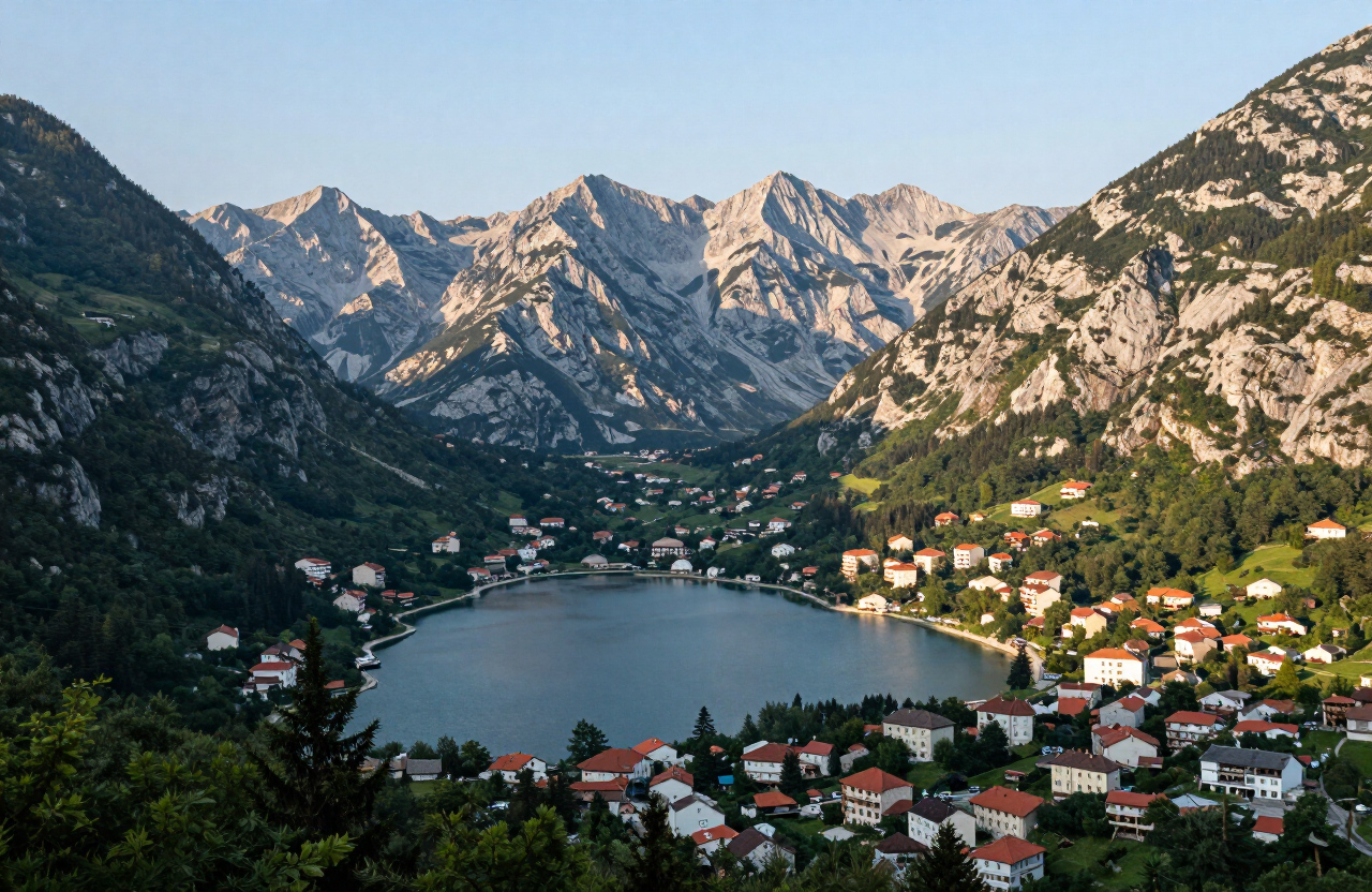
2 DAYS

Durmitor, Tara Canyon and Piva

Extends the western introduction south-west to Plužine & Piva — the Piva Lake reservoir, the relocated Piva Monastery and the dispersed canyon and village landscapes of Piva Nature Park. The Piva corridor involves long tunnels and narrow canyon roads, so plan it as a separate road-transfer day rather than a short detour, and confirm current road, fuel and access conditions directly before committing.

3 DAYS

Kolašin, Biogradska Gora and Prokletije

A separate eastern block covering Kolašin and the Biogradska Gora primeval rainforest around Biogradsko Lake, followed by the long transfer to Plav, Gusinje and the Prokletije valleys — Grebaje, Ropojana, Ali Pasha Springs and Oko Skakavice. Treat the transfer between the two as a proper mountain journey, and keep every trail, spring, lake and border-area outing conditional on current weather, trail, road and access conditions.

EXPLORE THE REGION

On the map

ATTRACTIONS

Sights worth the detour

FOOD & DRINK

Where and what to eat

01

Savardak — traditional Durmitor dishes near the town

02

Pizzeria Durmitor — a practical town-centre staple

03

Mountain guesthouse kitchens — hearty soups, grilled meats, dairy dishes and other highland food around Žabljak

04

Đurđevića Tara Bridge restaurants — seasonal eateries near the bridge serving grilled meats, trout and Montenegrin mountain fare; opening is seasonal and conditional, so check locally before relying on them

05

Mountain guesthouse kitchens around Đurđevića Tara — hearty soups, lamb, dairy dishes and highland food at nearby katuns and guesthouses; advance enquiry is often needed

06

Žabljak eateries — Savardak and Pizzeria Durmitor in nearby Žabljak, the practical base for meals when bridge-area restaurants are closed or full

07

Konoba Lupo — mountain dishes in the town centre

08

Mali Sir — cheese and dairy from the Bjelasica katuns

PLACES TO STAY

Where to sleep

01

Hotel Polar Star — modern rooms in town

02

Eko Katun H2O — mountain huts on the plateau

03

Family-run chalets and apartments — flexible self-catering bases in and around Žabljak

04

Guesthouses and cabins at Đurđevića Tara — a small number of rooms and cabins near the bridge; availability is limited and seasonal, so book ahead

05

Hotel Polar Star and chalets in Žabljak — the practical base 20 km south, with modern rooms and self-catering chalets for a canyon-and-mountain stay

06

Rafting-camp lodges along the Tara — licensed river operators’ camp lodges on the upstream and downstream reaches; stay is tied to a booked rafting trip and arranged through the operator

07

Hotel Bianca — a resort and spa base in Kolašin

08

Brile Hotel — a modern town-centre hotel close to the ski lifts

ROUTES

Routes through here

scenic-road

Durmitor Ring and Piva Canyon — Žabljak to Plužine

A one-way scenic mountain traverse from Žabljak across the Jezerska plateau, Sedlo pass and Trsa to the Piva canyon and Plužine — the high-country half of the Durmitor Ring rather than the complete circuit.

1 days · challenging

VIEW ROUTE
scenic-road

The Complete Durmitor Ring — Žabljak, Sedlo, Piva Canyon and Šavnik

The full circular drive around the Durmitor massif — from Žabljak over the Jezerska plateau and the Sedlo pass to Trsa and Plužine, along the Piva lake shore, then back east through Šavnik to close the loop.

1 days · challenging

VIEW ROUTE
campervan

Durmitor Ring by Campervan — RV Guide to the Full Circuit

The complete Durmitor Ring planned for campervans and RVs — the same Žabljak–Sedlo–Plužine–Piva–Šavnik circuit, read through a campervan lens: turnaround reality, fuel, overnights, season and narrow-section cautions.

2 days · challenging

VIEW ROUTE
road-trip

Northern Montenegro Grand Tour — Kolašin, Tara, Durmitor and Piva

A three-day editorial touring sequence across Northern Montenegro — from Kolašin and Biogradska Gora to the Tara canyon and Đurđevića Tara Bridge, on to Žabljak and Durmitor, and finally over the Sedlo pass and Trsa to the Piva canyon and Plužine.

3 days · challenging

VIEW ROUTE
road-trip

Eastern Highlands Road — Kolašin to Plav and Gusinje

A two-day editorial touring sequence across Montenegro’s eastern highlands — from Kolašin and Biogradska Gora’s primeval forest, via the Andrijevica corridor, to Plav Lake, the multi-community town of Gusinje, the Ali Pasha Springs and the Grebaje Valley beneath the Karanfili peaks.

2 days · challenging

VIEW ROUTE
hiking

Bobotov Kuk from Sedlo — Durmitor Summit Route

A serious circular summit day on the Durmitor massif from the Sedlo pass, via Zeleni Vir, to Bobotov Kuk (2,523 m) and back — alpine terrain, scrambling, exposure and fixed cables for properly equipped and experienced hikers.

9.5 km · 7 h · challenging

VIEW ROUTE

KEEP EXPLORING

Keep exploring

Destinations, stories and road trips from every corner of the region — and the country beyond.