
Fortress
Pset Fortress
Bosanska Krupa · Northwest Bosnia / Krajina
QUICK INFORMATION
- CATEGORY
- Fortress
- COUNTRY
- Bosnia & Herzegovina
- REGION
- Bosanska Krupa · Northwest Bosnia / Krajina
- DURATION
- 1–2 days
ABOUT THIS ATTRACTION
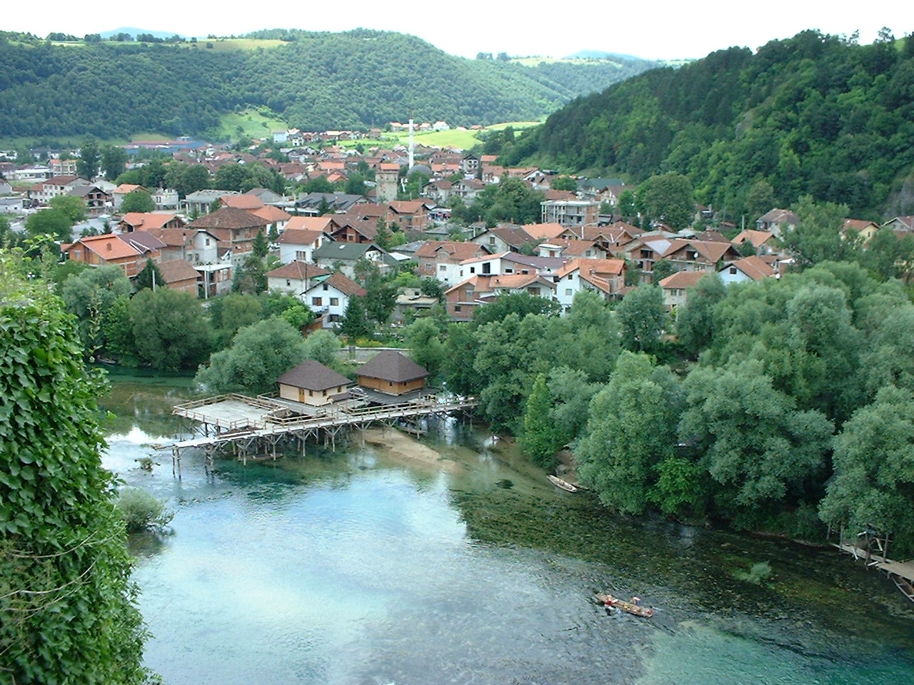
Pset is the ruined fortress that crowns the steep hill above Bosanska Krupa, looking out over the Una and the town below. What survives is a stone tower — the kula — and stretches of wall, enough to read the defensive form of a stronghold that once commanded the river crossing and the route along the Una valley. The climb to the fortress is short but steep, and the reward is the view: the green river, the islands and the wooden bridges laid out beneath, and the Krajina hills rolling away on every side. For a visitor Pset is the natural starting point of a Bosanska Krupa day, because from up here the whole layout of the town — the river, the islands, the bridges and the mills — reads at a glance, just as it did for the people who built the fortress to watch over it.
HISTORY & BACKGROUND
The story behind it
Pset is a medieval fortification, one of the strongholds that guarded the Una valley in the period when this was a contested frontier between the medieval Bosnian state, the Hungarian crown and the advancing Ottomans. The fortress controlled a crossing of the Una and the road that ran along the river, and it remained in use under Ottoman rule, when the Krajina was organised as a military borderland. The exact date of its construction is not firmly established in the available sources, and the fortress is known above all through its surviving remains and its long association with the town. Local tradition connects Pset with the figure of Krupana, a woman of legend linked to the fortress and the name of the place; this is local tradition rather than documented historical fact, and it is best treated as part of the folklore of the Krajina rather than as a dated record. The fortress is today a protected cultural monument, preserved as a ruin and open to the hillside.
WHAT TO SEE
What to see here
The tower (kula) — the surviving stone tower, the most complete piece of the fortress, where the defensive form of the stronghold is clearest.
The walls and fragments — the stretches of curtain wall that remain, enough to trace the outline of the original fortification.
The view over the Una — the panorama from the hill over the river, the islands, the wooden bridges and the town, the reason the fortress was built here.
The hillside approach — the short steep climb to the fortress, part of the experience of reading the stronghold against the river below.
WHY IT MATTERS
Why it matters
Pset is the reason Bosanska Krupa exists where it does — a defended crossing of the Una — and it is the one place from which the whole town is understood at a glance. For a visitor it is the historical anchor of a visit and the best viewpoint over the river landscape that defines the place.
PRACTICAL INFORMATION
Before you go
MAP & LOCATION
Pset Fortress
Pset Fortress, Bosanska Krupa, Northwest Bosnia / Krajina, Bosnia & Herzegovina
44.8850, 16.1551
MORE ATTRACTIONS
More to see in Bosanska Krupa


FOOD & DRINK
Where to eat nearby
Una-side restaurants and riverside grills — river trout and Krajina grills near the water
Town-centre cafés and bakeries around the central streets and the bridges
HOTELS & STAYS
Where to stay nearby
Central Bosanska Krupa guesthouses and small hotels within walking distance of the river and the bridges
Riverside accommodation on the edge of town, close to the islands and the bathing spots
ITINERARIES
Day-by-day routes


NEARBY DESTINATIONS
Continue the journey

INTERESTS
Explore by what you love
ROUTES
Routes through here
Una Canyon Scenic Road — Bihać to Bosanska Otoka
A scenic run down the M14 along the Una canyon from Bihać, via Ostrožac Castle and Bosanska Krupa, to the river-island village of Bosanska Otoka.
55 km · easy
VIEW ROUTEKostela–Bosanska Krupa Una Kayak Descent
A guided kayak descent of the Una from the Kostela area towards Bosanska Krupa — an operator-led river run of roughly 20 km with sections commonly described as Class II–III.
20 km · 4 h · moderate
VIEW ROUTEPART OF
Keep exploring
The atlas goes on — more attractions, destinations and stories from every corner of the world.