
Nature & Hiking
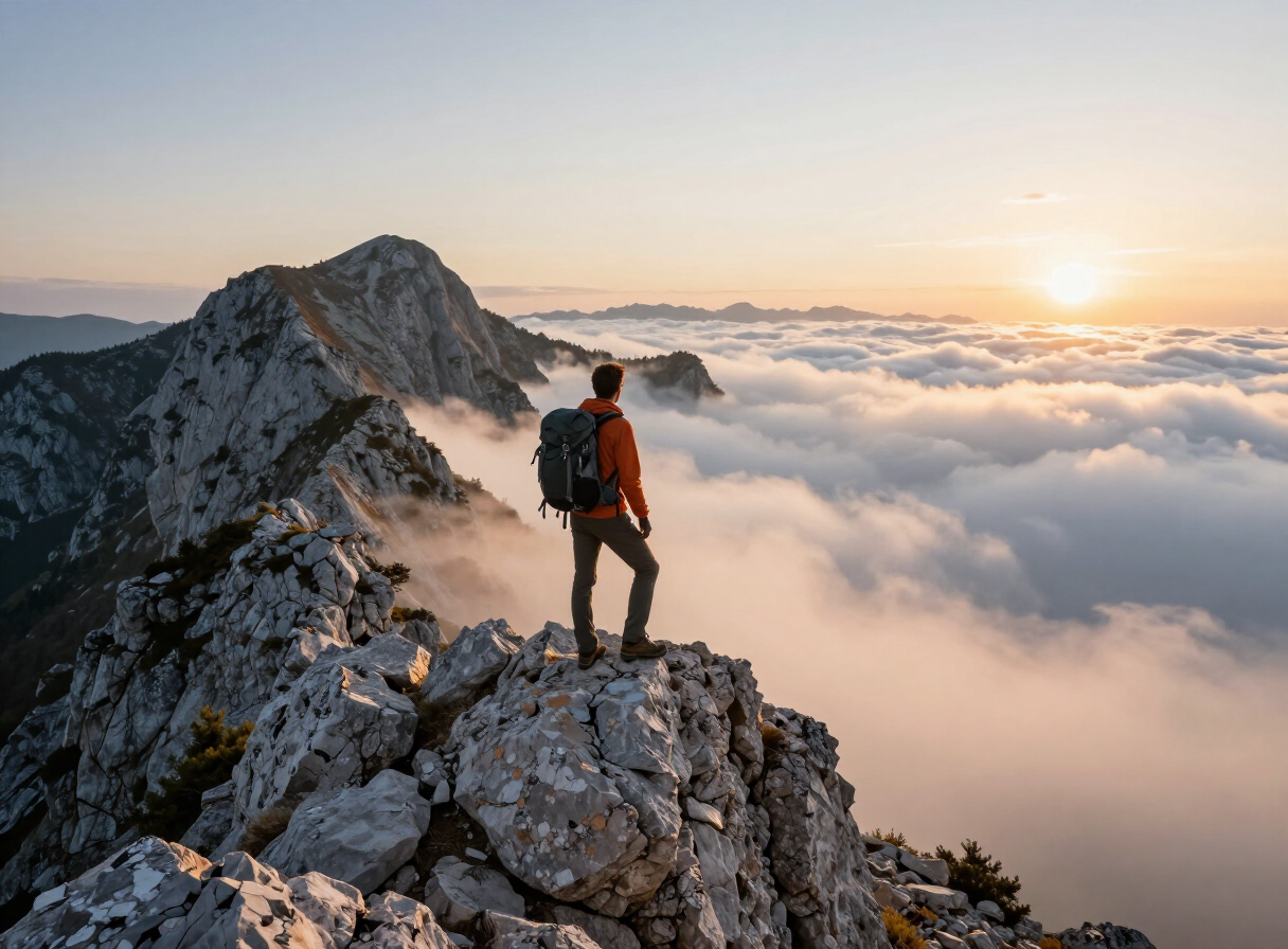
Hike through the mountains and landscapes of Sutjeska
Sutjeska National Park · Eastern Bosnia
QUICK INFORMATION
- CATEGORY
- Nature & Hiking
- COUNTRY
- Bosnia & Herzegovina
- REGION
- Sutjeska National Park · Eastern Bosnia
- DURATION
- Full days in the mountains; the span of the park allows anything from a single long day to a multi-day traverse.
- DIFFICULTY
- Ranges from gentler plateau walking to demanding high-mountain ground; plan routes with the park authorities or a certified guide.
- BEST TIME
- Late spring to early autumn for reliable access; the high ground holds snow into early summer. Confirm conditions with the park authorities.
ABOUT THIS EXPERIENCE
Beyond the protected reserve of Perućica, the great experience of Sutjeska is simply to walk through its mountain landscape. The park packs a complete stretch of the Dinaric Alps into a compact area: the Sutjeska canyon cutting through the limestone, the high peak of Maglić rising above it, the open plateau and glacial lakes of Zelengora to the west, and the forested slopes that hold it all together. A hiking journey through Sutjeska moves between these worlds — from the canyon floor at Tjentište up onto the ridges, across the plateau to the lakes, and into the view of the primeval forest basin from above. It is the experience that turns the park’s separate sights into a single picture of a wilderness, and it is the reason most visitors come: long days in the mountains, earned views, and a landscape that combines canyon, peak, plateau and old-growth forest in one place.
WHAT YOU’LL EXPERIENCE
What you’ll experience
A hiking journey through Sutjeska is built around the park’s mountain landscape rather than a single summit. From the Tjentište hub in the valley, routes climb onto the surrounding heights — toward the Maglić massif above the Perućica basin, out onto the rolling Zelengora plateau and its glacial lakes, and along the forested slopes above the Sutjeska canyon. The experience is one of moving between the park’s different worlds: the deep canyon, the open plateau, the high peaks and the viewpoints over the primeval forest. The lakes of Zelengora — the “mountain eyes” — are natural destinations and rest points on the plateau, and the heights above Perućica give the view into the old-growth basin that most visitors never enter. The walking ranges from gentler plateau days to demanding high-mountain ground, and the weather across all of it can change quickly. It is the experience that best reveals the scale and variety of Sutjeska, and the one that most visitors remember.
THE EXPERIENCE IN DETAIL
What it’s really like
HIGHLIGHTS
Moments worth savouring
The Sutjeska canyon — the deep limestone gorge that gives the park its name, the starting layer of any journey through the landscape.
The high peaks — the Maglić massif above the Perućica basin, the roof of the country and the park’s dominant height.
The Zelengora plateau and lakes — the open rolling high country west of the canyon, with its glacial “mountain eyes” as natural destinations.
Viewpoints over Perućica — the view into the primeval forest basin from the surrounding heights, the way most visitors see the reserve.
Earned, empty trails — long mountain days with views that are worked for, the core of the Sutjeska hiking experience.
A complete Dinaric landscape — canyon, peak, plateau and old-growth forest in one compact area, read together on foot.
WHAT TO EXPECT
Good to know before you go
Hiking in Sutjeska is high-mountain walking and should be planned with care. Routes range from gentler days on the Zelengora plateau to demanding ground on the high peaks, and the weather can change quickly even in summer, with fog and storms a real consideration on the heights. Arrange routes through the Sutjeska National Park authorities or a certified local guide, especially for the higher ground, and check conditions before setting out. Sturdy boots, layered clothing, water and navigation are the baseline; snow can linger on the high ground into early summer, shortening the reliable season. The park’s visitor facilities and access points are concentrated at Tjentište, which is the natural base. No specific routes, timings or difficulty ratings are listed here — consult the park authorities or a guide for current route information and conditions.
WHY IT MATTERS
Why it matters
The mountain landscape is the connective tissue of Sutjeska — the thing that links the primeval forest, the highest peak, the plateau lakes and the canyon into one destination. A hiking journey through it is the experience that reveals the park as a single wilderness rather than a list of separate sights, and it is the reason most visitors come to Sutjeska in the first place.
PRACTICAL INFORMATION
Before you go
MAP & LOCATION
Hike through the mountains and landscapes of Sutjeska
Hike through the mountains and landscapes of Sutjeska, Sutjeska National Park, Eastern Bosnia, Bosnia & Herzegovina
43.3400, 18.6600
ATTRACTIONS NEARBY
Pair it with these sights


MORE EXPERIENCES
More to do in Sutjeska National Park

FOOD & DRINK
Where to eat nearby
Tjentište — the park’s hub, with the main visitor facilities and food options near the memorial
Mountain lodges and small providers within the park — hearty, simple fare for hikers
HOTELS & STAYS
Where to stay nearby
Tjentište — the classic park base, with accommodation and visitor facilities concentrated here
Mountain huts and camps for hikers on the longer routes across the park
ITINERARIES
Day-by-day routes


TRAVEL GUIDES
Practical guides

NEARBY DESTINATIONS
Continue the journey

INTERESTS
Explore by what you love
PART OF
Keep exploring
The atlas goes on — more attractions, destinations and stories from every corner of the world.