
Cultural Landscape
Vražje and Riblje Lakes with the Stećci Landscape
Žabljak · Durmitor & Northern Mountains
QUICK INFORMATION
- CATEGORY
- Cultural Landscape
- COUNTRY
- Montenegro
- REGION
- Žabljak · Durmitor & Northern Mountains
- DURATION
- 2–3 days
ABOUT THIS ATTRACTION
The Vražje and Riblje lakes area is a dispersed cultural landscape on the Jezerska plateau west of Žabljak — two glacial lakes set in wide open grassland beneath the high rim of the Durmitor massif, with medieval stećci tombstones scattered through the nearby graveyards. The lakes and the graveyard sites are separate locations, not one continuous site, and moving between them requires respectful, careful travel across the plateau. Together they make a single landscape of natural and medieval heritage: the glacial “mountain eyes” that give Durmitor its character, and the carved stone tombstones that record the people who lived and were buried here in the late Middle Ages.
HISTORY & BACKGROUND
The story behind it
Vražje and Riblje are two of Durmitor’s 18 glacial lakes, formed by ice during the last ice age when glaciers carved basins in the limestone that later filled with meltwater. The Jezerska plateau around them has been used for summer grazing for centuries, and the medieval stećci tombstones found in the graveyards nearby date from the 12th to 16th centuries — carved stone markers belonging to the Vlach and Slavic Christian communities of the medieval Bosnian and Serbian states. The stećci are a protected heritage type, inscribed on the UNESCO World Heritage List in 2016 as part of the serial transnational “Stećci Medieval Tombstone Graveyards” listing, and the lakes lie within Durmitor National Park, itself a UNESCO site since 1980.
WHAT TO SEE
What to see here
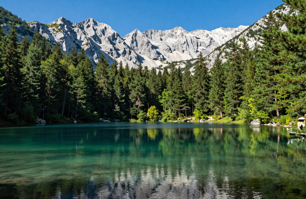
Vražje Lake — a glacial lake in open grassland on the Jezerska plateau, one of Durmitor’s “mountain eyes”, with the high massif rising behind it.
Riblje Lake — the second of the pair, a short distance away, smaller and set in the same open plateau grassland.
The medieval stećci graveyards — protected carved stone tombstones from the 12th–16th centuries in nearby graveyard sites, a separate location from the lakes.
The open Jezerska plateau — the wide grassland that connects the lakes and the graveyard sites, the setting that makes the area a single dispersed landscape.
WHY IT MATTERS
Why it matters
The Vražje and Riblje area brings together two things that define Durmitor — its glacial lakes and its medieval heritage — in one dispersed landscape on the high plateau. For a visitor it is the place to see the massif’s “mountain eyes” away from the busier Black Lake, alongside stećci tombstones that record the medieval communities of the region. But it is a spread-out site: the lakes and the graveyards are separate locations requiring respectful movement between them, and the stećci are protected medieval tombstones, not picnic furniture or climbing objects.
PRACTICAL INFORMATION
Before you go
THROUGH THE LENS
From the road


MAP & LOCATION
Vražje and Riblje Lakes with the Stećci Landscape
Vražje and Riblje Lakes with the Stećci Landscape, Žabljak, Durmitor & Northern Mountains, Montenegro
43.0839, 19.1456
MORE ATTRACTIONS
More to see in Žabljak

THINGS TO DO
Things to do nearby
FOOD & DRINK
Where to eat nearby
Savardak — traditional Durmitor dishes near the town
Pizzeria Durmitor — a practical town-centre staple
Mountain guesthouse kitchens — hearty soups, grilled meats, dairy dishes and other highland food around Žabljak
HOTELS & STAYS
Where to stay nearby
Hotel Polar Star — modern rooms in town
Eko Katun H2O — mountain huts on the plateau
Family-run chalets and apartments — flexible self-catering bases in and around Žabljak
NEARBY DESTINATIONS
Continue the journey

ROUTES
Routes through here
Durmitor Ring and Piva Canyon — Žabljak to Plužine
A one-way scenic mountain traverse from Žabljak across the Jezerska plateau, Sedlo pass and Trsa to the Piva canyon and Plužine — the high-country half of the Durmitor Ring rather than the complete circuit.
1 days · challenging
VIEW ROUTEThe Complete Durmitor Ring — Žabljak, Sedlo, Piva Canyon and Šavnik
The full circular drive around the Durmitor massif — from Žabljak over the Jezerska plateau and the Sedlo pass to Trsa and Plužine, along the Piva lake shore, then back east through Šavnik to close the loop.
1 days · challenging
VIEW ROUTEDurmitor Ring by Campervan — RV Guide to the Full Circuit
The complete Durmitor Ring planned for campervans and RVs — the same Žabljak–Sedlo–Plužine–Piva–Šavnik circuit, read through a campervan lens: turnaround reality, fuel, overnights, season and narrow-section cautions.
2 days · challenging
VIEW ROUTENorthern Montenegro Grand Tour — Kolašin, Tara, Durmitor and Piva
A three-day editorial touring sequence across Northern Montenegro — from Kolašin and Biogradska Gora to the Tara canyon and Đurđevića Tara Bridge, on to Žabljak and Durmitor, and finally over the Sedlo pass and Trsa to the Piva canyon and Plužine.
3 days · challenging
VIEW ROUTEBobotov Kuk from Sedlo — Durmitor Summit Route
A serious circular summit day on the Durmitor massif from the Sedlo pass, via Zeleni Vir, to Bobotov Kuk (2,523 m) and back — alpine terrain, scrambling, exposure and fixed cables for properly equipped and experienced hikers.
9.5 km · 7 h · challenging
VIEW ROUTEDurmitor Ring Cycling Circuit — Žabljak, Trsa and Sušica
A challenging full-day road-cycling circuit of the Durmitor ring road from Žabljak, over Mala Crna Gora and Nedajno to Trsa, and back through Pišče and the Sušica valley — active mountain roads, long climbs and descents for experienced, self-sufficient cyclists.
76 km · challenging
VIEW ROUTEPART OF
Keep exploring
The atlas goes on — more attractions, destinations and stories from every corner of the world.