
Scenic Driving & Walking
Explore Žabljak's Glacial Lakes and Mountain Heritage
Žabljak · Durmitor & Northern Mountains
QUICK INFORMATION
- CATEGORY
- Scenic Driving & Walking
- COUNTRY
- Montenegro
- REGION
- Žabljak · Durmitor & Northern Mountains
- DURATION
- 4–6 h
- DIFFICULTY
- Easy walking on marked paths, with careful driving on narrow seasonal mountain roads. Not a summit route.
- BEST TIME
- June to September, and only after a same-day check of weather, road and path access. No stop is guaranteed.
ABOUT THIS EXPERIENCE
Durmitor’s glacial lakes are not one site. Black Lake lies a short way from Žabljak; Vražje, Riblje and other “mountain eyes” sit further out on the Jezerska plateau and the high limestone. This experience is the practical way to read that spread: start in the mountain town, travel separately to the Black Lake area, then continue only as far as a selected lake landscape if roads, weather and daylight allow. It is scenic driving with short walks on marked paths, not a single trail and not a summit day. Nothing on the route — parking, paths, viewpoints or facilities — should be treated as guaranteed.
WHAT YOU’LL EXPERIENCE
What you’ll experience
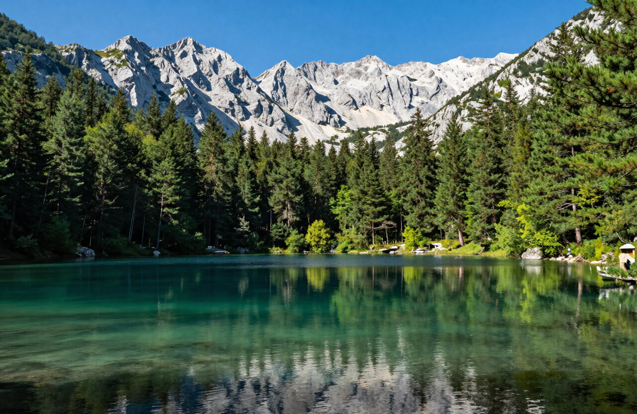
You leave the Žabljak centre by road and travel first toward Black Lake, walking only the marked shore paths if they are open and conditions are sound. A second, separate drive crosses plateau roads toward a selected glacial-lake landscape such as the Vražje and Riblje area, where open grassland, limestone rims and, nearby, medieval stećci give the plateau its mountain-heritage character. Between stops the road is narrow, shared with walkers, cyclists and livestock, and the weather can close from clear to fog, rain or snow in a short time. You park only in lawful places, stay on marked public paths, and turn back when a road, path or viewpoint is closed, icy or unclear. The day ends back in town; it does not assume a café, a ranger, or a clear view at any stop.
THE EXPERIENCE IN DETAIL
What it’s really like
HIGHLIGHTS
Moments worth savouring
Separate travel from Žabljak town to the Black Lake area — a short drive or walk, not the same stop as the plateau lakes.
A selected glacial-lake landscape beyond town, such as Vražje Lake on the Jezerska plateau, reached only if the road is open.
Mountain heritage in the open plateau — grassland katun country and nearby medieval stećci, treated as protected stones, not climbing objects.
Narrow mountain roads and marked paths only — slow driving, lawful parking, and no off-trail shortcuts to a shoreline or rim.
No guaranteed access or facilities — weather, snow, closures and daylight can remove any stop, and services must not be assumed.
WHAT TO EXPECT
Good to know before you go
Allow 4–6 hours and expect to shorten the plan. Roads between town, Black Lake and the plateau lakes are separate links, narrow in places, and seasonal; outside summer they may be snowbound. Check current road, parking and path conditions in Žabljak before leaving, carry water and warm layers, and use an offline map because mobile coverage is patchy. Do not assume fuel, food, toilets, a visitor centre or rescue response at the lakes. Stećci, where you encounter them, are protected medieval tombstones — do not climb on or damage them. Do not walk onto frozen lakes. If fog, ice, snow or a closed road appears, the correct decision is to return to town.
WHY IT MATTERS
Why it matters
Žabljak’s identity is the gateway to a dispersed glacial landscape, not a single lakeside promenade. Moving deliberately between the town, Black Lake and one further lake landscape shows both the resort’s mountain-tourism role and the plateau heritage around it — and it does so without pretending that every road, path or facility will be open. For a visitor it is the realistic half-day when a full canyon or summit objective is the wrong choice.
PRACTICAL INFORMATION
Before you go
THROUGH THE LENS
From the road


MAP & LOCATION
Explore Žabljak's Glacial Lakes and Mountain Heritage
Explore Žabljak's Glacial Lakes and Mountain Heritage, Žabljak, Durmitor & Northern Mountains, Montenegro
43.1556, 19.1231
ATTRACTIONS NEARBY
Pair it with these sights

MORE EXPERIENCES
More to do in Žabljak
FOOD & DRINK
Where to eat nearby
Savardak — traditional Durmitor dishes near the town
Pizzeria Durmitor — a practical town-centre staple
Mountain guesthouse kitchens — hearty soups, grilled meats, dairy dishes and other highland food around Žabljak
HOTELS & STAYS
Where to stay nearby
Hotel Polar Star — modern rooms in town
Eko Katun H2O — mountain huts on the plateau
Family-run chalets and apartments — flexible self-catering bases in and around Žabljak
NEARBY DESTINATIONS
Continue the journey

INTERESTS
Explore by what you love
PART OF
Keep exploring
The atlas goes on — more attractions, destinations and stories from every corner of the world.