Natural Site
Bay of Kotor
Kotor · Bay of Kotor
QUICK INFORMATION
- CATEGORY
- Natural Site
- COUNTRY
- Montenegro
- REGION
- Kotor · Bay of Kotor
- DURATION
- 1–2 days
ABOUT THIS ATTRACTION
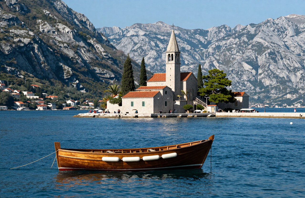
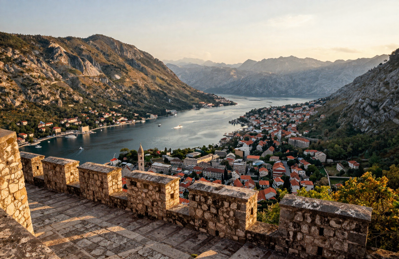
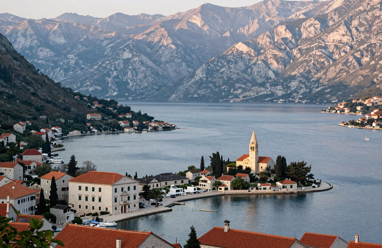
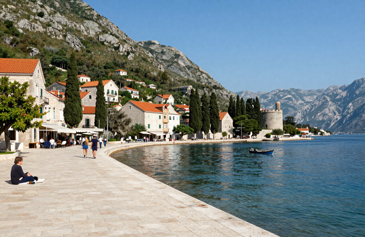
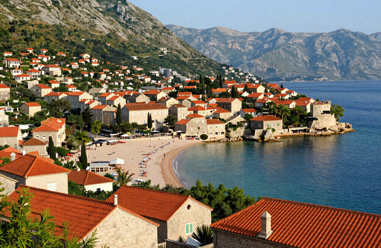
The Bay of Kotor (Boka Kotorska) is the drowned river valley into which Kotor is folded — a winding inlet of deep blue water hemmed by sheer limestone mountains, often described as Europe’s southernmost fjord though it was carved not by ice but by river erosion and later flooded by the sea. It is not a single bay but a sequence of connected basins — Herceg Novi, Tivat, Risan and Kotor — narrowed at points to straits, of which the Verige is the tightest. The bay is the geographic reason Kotor exists: the town sits at the head of the innermost basin, and every view of it is shaped by the mountains dropping straight into the water on every side.
HISTORY & BACKGROUND
The story behind it
The Bay of Kotor is a ria — a river valley drowned by the rising sea after the last ice age — rather than a true glacial fjord, though its steep walls and deep water give it a fjord-like appearance. The bay has been a navigable sheltered waterway since antiquity, and its shores were settled by Illyrians, Romans and Byzantines before becoming the heart of Venetian naval power on the eastern Adriatic. The towns around its shores — Herceg Novi, Perast, Risan, Kotor — each grew at the head of a basin or beside a strait, defended by walls and fortresses. In 1979 the bay and its historic towns were inscribed together as the Natural and Culturo-Historical Region of Kotor on the UNESCO World Heritage List.
WHAT TO SEE
What to see here
The Verige strait — the narrowest point of the bay, separating the outer from the inner basins, the natural gateway that every boat passes through.
The chapel islands off Perast — the natural Sveti Đorđe and the man-made Our Lady of the Rocks, the bay’s most photographed pair.
The approach to Kotor by water — the long sail up the inner basins with the walls of the old town and the ramparts climbing the cliff slowly revealing themselves.
The surrounding peaks — Mount Lovćen’s foothills and the Orjen massif drop directly into the bay, the vertical landscape that defines the whole region.
WHY IT MATTERS
Why it matters
The bay is not a backdrop to Kotor but its reason for being, and the two are listed together by UNESCO for that reason. For a visitor, seeing the bay from the water — rather than only from the town — is what reveals the scale of the landscape: the way the mountains rise from the sea and the old towns sit at the heads of their basins. It is the single best way to understand why Kotor looks the way it does.
PRACTICAL INFORMATION
Before you go
THROUGH THE LENS
From the road
MAP & LOCATION
Bay of Kotor
Bay of Kotor, Kotor, Bay of Kotor, Montenegro
42.4667, 18.6833
MORE ATTRACTIONS
More to see in Kotor


THINGS TO DO
Things to do nearby
FOOD & DRINK
Where to eat nearby
Galion — seafood beside the old town walls
Tanja — traditional Montenegrin dishes near the river gate
Old Town konobas — seafood, grilled fish and Montenegrin dishes in the lanes around the cathedral
HOTELS & STAYS
Where to stay nearby
Hotel Astoria — boutique rooms inside the old town
Hostel Old Town — a budget base steps from the walls
Dobrota waterfront stays — quieter rooms and apartments within walking distance or a short local ride of the old town
NEARBY DESTINATIONS
Continue the journey
ROUTES
Routes through here
Kotor Serpentine Panorama — Old Town to Horizont Viewpoint
A careful scenic climb up the historic Kotor–Cetinje serpentine road from Kotor Old Town to the lower panorama point and the higher Horizont viewpoint, with widening views over the bay, Muo, Prčanj and the surrounding mountains.
1 days · challenging
VIEW ROUTEBay of Kotor Heritage Circuit — Kotor, Perast, Herceg Novi and Luštica
A two-day heritage road-trip around the Bay of Kotor — from Kotor Old Town along the northern shore to Perast and Herceg Novi, then back through Tivat and onto the Luštica peninsula toward Rose.
2 days · moderate
VIEW ROUTEPART OF
Keep exploring
The atlas goes on — more attractions, destinations and stories from every corner of the world.