
Mountain Hiking
Hike from Biogradsko Lake to Bendovac
Kolašin · Durmitor & Northern Mountains
QUICK INFORMATION
- CATEGORY
- Mountain Hiking
- COUNTRY
- Montenegro
- REGION
- Kolašin · Durmitor & Northern Mountains
- DURATION
- 4–6 h
- DIFFICULTY
- A proper uphill mountain hike with real elevation gain, mud, roots, steep terrain and exposure — suitable for fit, equipped walkers on a confirmed route in settled weather only. Suitability depends on current conditions and the discipline to turn back.
- BEST TIME
- June to September in settled weather only; outside summer, snow, ice and fog can make the route unsafe or close the view entirely. Check conditions locally before setting out.
ABOUT THIS EXPERIENCE
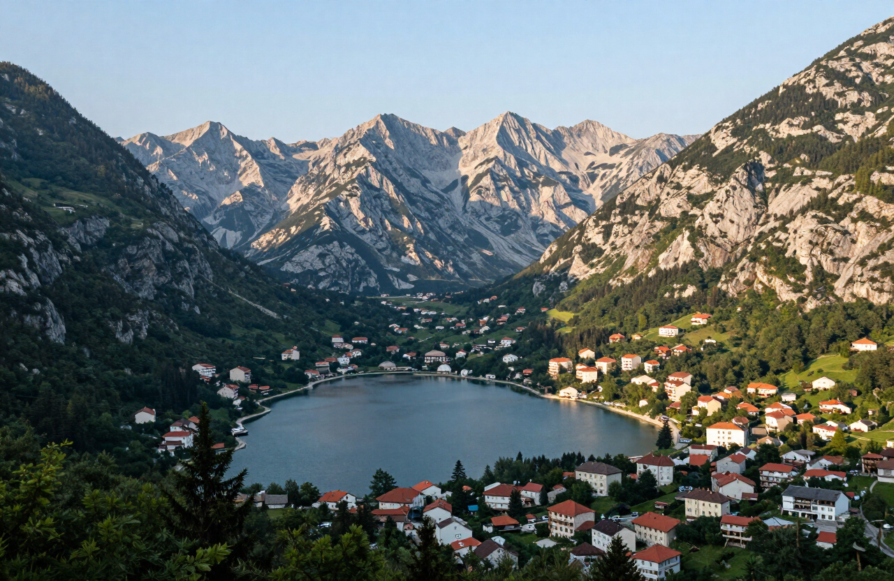
The hike from Biogradsko Lake to Bendovac is a proper uphill mountain outing, not a lakeside stroll — a route that climbs through forest and open slope on the Bjelasica range, gaining real elevation before the outlook over the lake, the primeval forest and the wider massif opens up. It demands the usual mountain judgement throughout: mud, roots and uneven ground underfoot, steep terrain, exposure to weather on the upper slopes, mist that can close in and hide the view entirely, and the need for navigation, sufficient water, daylight and a willingness to turn back. The viewpoint is only worth attempting in settled weather, on a confirmed marked route, with the fitness and gear for a real mountain day — and with the discipline to abandon the climb if conditions deteriorate. Trails, viewpoints, markers and access are never guaranteed and must be checked locally.
WHAT YOU’LL EXPERIENCE
What you’ll experience
THE EXPERIENCE IN DETAIL
What it’s really like
HIGHLIGHTS
Moments worth savouring
A proper uphill mountain hike with real elevation gain from the Biogradsko Lake area to the Bendovac viewpoint — not a roadside stop or a gentle stroll.
The panoramic outlook over Biogradsko Lake, the primeval forest and the Bjelasica massif, only visible in clear weather and never guaranteed when mist closes in.
Forest and open slope underfoot with mud, roots and uneven ground, demanding sturdy footwear, sure footing and steady mountain judgement.
Exposed upper slopes where mist, wind, rain and rapid temperature swings are real hazards — carry warm and waterproof layers, navigation and sufficient water.
A route that demands a confirmed marked trail, an early start, enough daylight and the discipline to turn back if conditions deteriorate or the view is lost.
WHAT TO EXPECT
Good to know before you go
This is a mountain hike, not a lakeside walk, and it should only be attempted in settled weather on a confirmed marked route. The climb gains real elevation through forest and open slope, with mud, roots and uneven ground throughout and exposure to weather on the upper sections. Mist can close in quickly and hide both the view and the route, snow and ice can linger on the high ground well into spring and return by autumn, and mobile coverage is patchy to absent on the upper slopes. Carry sturdy footwear, warm and waterproof layers, sufficient water and food, an offline map and a charged phone torch; start early enough to return in daylight, and turn back if conditions deteriorate, the trail is unclear, or daylight is short. Confirm the current route, trail conditions and access locally before setting out — do not assume trails, markers, viewpoints or any facilities are open or available.
WHY IT MATTERS
Why it matters
Bendovac is the high reward of the Biogradsko Lake area — the viewpoint that puts the lake, the primeval forest and the Bjelasica massif into a single mountain panorama — but it earns its view. It is a proper uphill mountain outing that demands real judgement: elevation, mud, roots, steep terrain, mist, exposure, navigation, water, daylight and the sense to turn back. For a visitor who treats it as the mountain day it is, in settled weather and on a confirmed route, it is the best outlook in the area; for anyone else it is a reason to stay lower.
PRACTICAL INFORMATION
Before you go
THROUGH THE LENS
From the road


MAP & LOCATION
Hike from Biogradsko Lake to Bendovac
Hike from Biogradsko Lake to Bendovac, Kolašin, Durmitor & Northern Mountains, Montenegro
42.8955, 19.6266
ATTRACTIONS NEARBY
Pair it with these sights
MORE EXPERIENCES
More to do in Kolašin
FOOD & DRINK
Where to eat nearby
Konoba Lupo — mountain dishes in the town centre
Mali Sir — cheese and dairy from the Bjelasica katuns
Savardak — traditional katun cooking above the tree line when open in season
HOTELS & STAYS
Where to stay nearby
Hotel Bianca — a resort and spa base in Kolašin
Brile Hotel — a modern town-centre hotel close to the ski lifts
Eko Katun Nevidio — highland katun accommodation on the Bjelasica slopes, seasonal
NEARBY DESTINATIONS
Continue the journey


INTERESTS
Explore by what you love
PART OF
Keep exploring
The atlas goes on — more attractions, destinations and stories from every corner of the world.