Seasonal conditions
Rideable year-round; best April–June and September–October. July–August is very busy with beach traffic. Verified 2026-11-07.
ROUTE
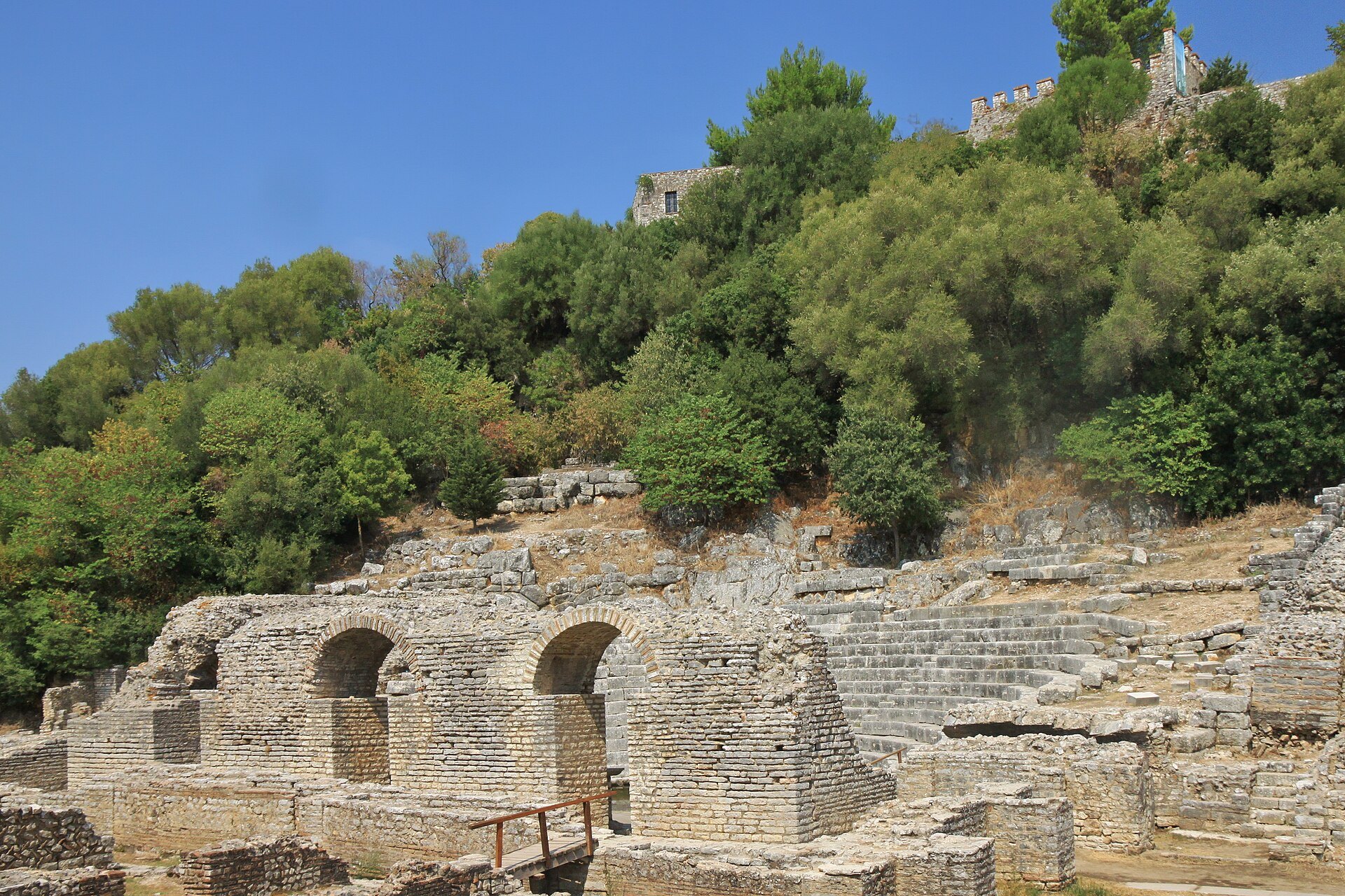
A short, easy ride from Sarandë past the salt lake of Butrint and the beaches of Ksamil to the UNESCO ancient city at the southern tip of Albania.
Marcin Konsek / Wikimedia Commons / CC BY-SA 4.0
ABOUT THIS ROUTE
Only 37 km, but every kilometre earns its place: the Vivari channel, the Ksamil islands on one side and Lake Butrint on the other, ending at one of the Mediterranean\u2019s great archaeological sites.
The road leaves Sarandë south along the coast, climbs gently past Lake Butrint and the salt flats of the Vivari channel, and drops into Ksamil with its four small offshore islands. From Ksamil it is a few minutes to the Butrint National Park gate, where the ancient city — Greek, Roman, Byzantine and Venetian layers around a freshwater lake — waits at the end of the peninsula. Combine the ride with the ferry across the channel to the quiet beach on the far side.
PLAN RESPONSIBLY
Rideable year-round; best April–June and September–October. July–August is very busy with beach traffic. Verified 2026-11-07.
Treat the published duration as riding time only. Follow posted limits, maintain space from larger vehicles, remove dark sunglasses before tunnels and never stop inside a tunnel or on an active traffic lane.
WAYPOINTS
Sarandë
start
Finiq (detour)
waypoint
Ksamil
waypoint
Butrint
end
MAP & ROUTE
DESTINATIONS

The Riviera’s southern capital — a horseshoe bay facing Corfu, tavernas on the promenade, Lëkurësi castle on the hill and Butrint’s ruins at the door.
Albanian Riviera

The Riviera’s beach capital — white-sand bays, four islands a swim from the shore, lagoon mussels at lunch and Butrint’s ruins next door.
Albanian Riviera

Albania’s world heritage masterpiece — a whole ancient city in a wetland park: Greek theatre, Roman forum, Byzantine baptistery and a Venetian castle, all inside one lagoon-side walk.
Albanian Riviera
WEATHER
Forecast data from Open-Meteo. Updated regularly.
NEARBY
REGIONS
KEEP EXPLORING
More routes, destinations and stories from every corner of the world — start where you like below.


