Seasonal conditions
Open year-round; best May to October. Check HAK traffic reports for border-free corridor updates and summer congestion around Dubrovnik. Verified 2026-11-07 (Hrvatski autoklub / HAK traffic conditions).
ROUTE
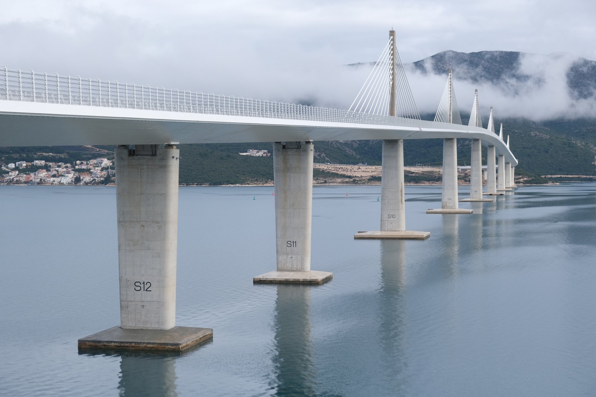
The southern finale of the Adriatic Highway — the Neretva delta, the medieval Ston walls, the new Pelješac bridge and the grand approach to Dubrovnik.
kalle / Wikimedia Commons / CC BY-SA 4.0
ABOUT THIS ROUTE
The last Croatian stretch of the Adriatic Highway crosses the Neretva citrus delta, passes beneath the longest stone walls in Europe at Ston, swings over the new Pelješac bridge and delivers you to Dubrovnik along one final, glittering coastline.
Leaving Ploče the road runs flat and fast through the Neretva delta — a completely different Dalmatia of reed beds, orchards and lagoons. After Ston, famous for its 14th-century defensive walls and oyster farms, the D8 crosses the Pelješac peninsula neck at the gateway to the wine region, then rejoins the coast at Slano. The final approach to Dubrovnik along the Rijeka dubrovačka bay is a memorable finish. Since 2022 the Pelješac bridge keeps the whole route inside Croatia — no border crossing with Bosnia and Herzegovina any more.
PLAN RESPONSIBLY
Open year-round; best May to October. Check HAK traffic reports for border-free corridor updates and summer congestion around Dubrovnik. Verified 2026-11-07 (Hrvatski autoklub / HAK traffic conditions).
Treat the published duration as riding time only. Follow posted limits, maintain space from larger vehicles, remove dark sunglasses before tunnels and never stop inside a tunnel or on an active traffic lane.
WAYPOINTS
Ploče
start
Ston
waypoint
Pelješac bridge
waypoint
Slano
waypoint
Dubrovnik
end
MAP & ROUTE
DESTINATIONS

The wine peninsula of southern Dalmatia — Ston’s great walls, Mali Ston oysters, the Dingač vineyards and the windy channel of Viganj.
Southern Dalmatia

A fortified Adriatic city of maritime history, monumental walls and living streets.
Southern Dalmatia

A pine-framed Adriatic harbour where Roman Epidaurum, Ragusan heritage, modern Croatian art and walkable swimming coves meet south of Dubrovnik.
Southern Dalmatia
INTERESTS
WEATHER
Forecast data from Open-Meteo. Updated regularly.
NEARBY
REGIONS
KEEP EXPLORING
More routes, destinations and stories from every corner of the world — start where you like below.

