destination360.orgPLACES / PEOPLE / STORIES
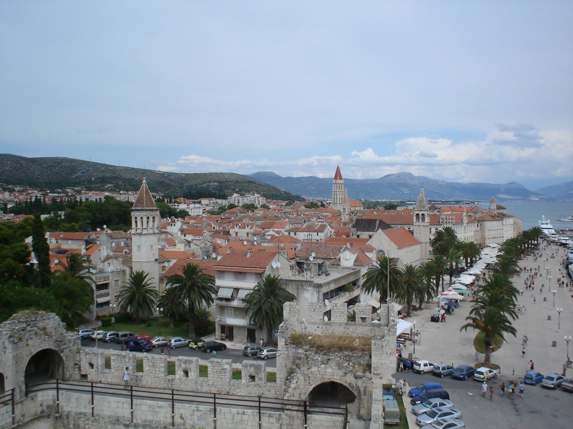
The UNESCO old town of Trogir seen from its medieval walls — a highlight stop on the Zadar to Split Adriatic Highway ride

ROUTE

Central Dalmatia Ride — Zadar to Split via Šibenik and Trogir

The classic Adriatic Highway run through Central Dalmatia — two UNESCO towns, the Šibenik channel, coastal bridges and the long seafront approach to Split.

scenic-road169 km3.5 hmoderate
DOWNLOAD GPX

<a href="//commons.wikimedia.org/w/index.php?title=User:SelfQ&amp;action=edit&am / Wikimedia Commons / CC BY-SA 3.0

ABOUT THIS ROUTE

The route in detail

The D8 between Zadar and Split strings together the best of Central Dalmatia: the channel ride out of Zadar, the fortress town of Šibenik and the Krka mouth, the UNESCO old towns of Šibenik and Trogir, and a sequence of seafront straights and short bridges that make this the most classic Croatian coastal ride.

Leaving Zadar the road crosses the canal to Bibinje and runs the Sukosan coast before the long inland gap towards Šibenik. From Šibenik the D8 returns to the sea at Brodarica and Primosten — one of the ride’s most photographed peninsulas — then pushes on to Trogir, where the old town sits on an islet between the mainland and Čiovo. The final hour along the Kaštela bay into Split makes a fitting finish with seven coastal castle villages in a row. Expect the heaviest traffic of all magistrala sections in July and August.
PLAN RESPONSIBLY

Season & safety

Seasonal conditions

Open year-round; best April to June and September to October. July-August beach traffic can turn the last hour into Split into a slow crawl — ride mornings. Check HAK traffic reports for seasonal roadworks. Verified 2026-11-07 (Hrvatski autoklub / HAK traffic conditions).

Key hazards

  • Shared coastal road with local traffic, buses and cyclists in season.
  • Sharp bends, narrow sections and occasional gravel or debris after rain or wind.
  • Tunnels and rapid light changes on some sections — keep a clear visor and remove sunglasses.
  • Strong bura (NE) wind episodes under Velebit and on exposed channel sections, mostly in winter.

Required gear

  • Certified motorcycle helmet and full protective riding gear.
  • Working lights and a clear visor suitable for tunnels and changing visibility.
  • Waterproof outer layer, an additional warm layer and charged phone.
  • Basic puncture and roadside emergency equipment appropriate for the motorcycle.

Check before you go

  • Check the current HAK traffic report (hak.hr) for the route sections.
  • Check the forecast for wind (especially bura) and rain along the coast.
  • Confirm sufficient fuel range — services thin out on the more remote sections.
  • Plan the ride within daylight and identify safe rest stops before departure.

Local guidance

Treat the published duration as riding time only. Follow posted limits, maintain space from larger vehicles, remove dark sunglasses before tunnels and never stop inside a tunnel or on an active traffic lane.

WAYPOINTS

Route points

  1. 01

    Zadar

    start

  2. 02

    Šibenik

    waypoint

  3. 03

    Primošten

    waypoint

  4. 04

    Split

    end

MAP & ROUTE

On the atlas

Elevation477 m high point4 m low point1,487 m total climbing18% steepest stretch (km 142)
477 m0 km166 km

INTERESTS

Why riders & travellers love it

WEATHER

Weather along the route

Forecast data from Open-Meteo. Updated regularly.

KEEP EXPLORING

The atlas continues

More routes, destinations and stories from every corner of the world — start where you like below.