Seasonal conditions
Mid-May to mid-October — Washington Pass closes with snow, typically early November to late April. Verified 2026-11-10 (route conditions).
ROUTE
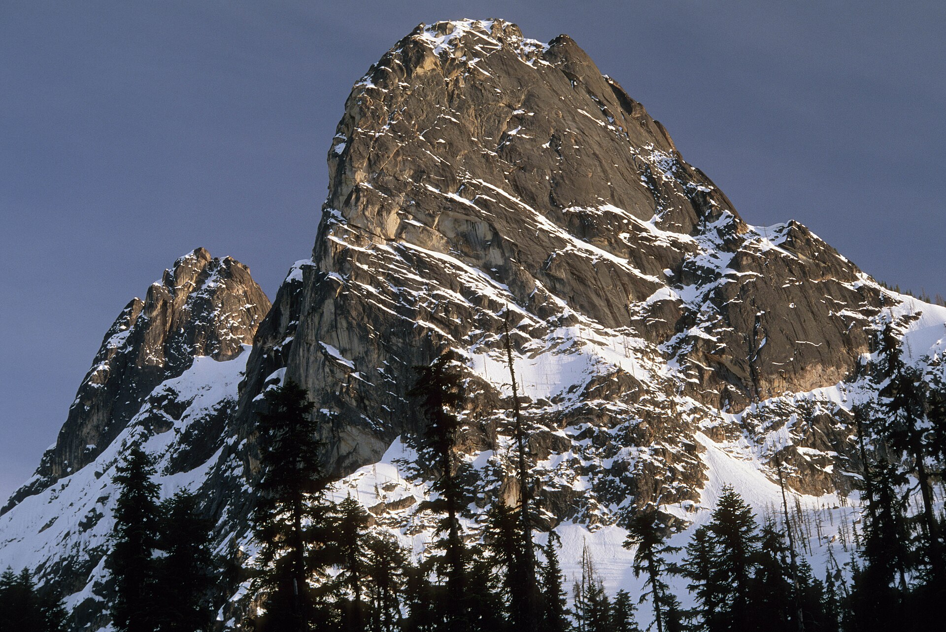
The Cascade peaks at their finest: SR-20 from the Skagit valley over Rainy and Washington passes to Winthrop — 206 km of dam lakes, switchbacks and 7,700-foot pass country.
U.S. Forest Service- Pacific Northwest Region / Wikimedia Commons / Public domain
ABOUT THIS ROUTE
The North Cascades Highway is the ride everything else in Washington is measured against. SR-20 leaves the Skagit valley fog at Sedro-Woolley and climbs through the narrow Gorge and Diablo dam country into the heart of the only true alpine range in the Lower 48 — jagged, glaciated and almost empty. Beyond Rainy Pass the road tops out at Washington Pass, where the Liberty Bell and Early Winters Spires stand right over the guardrail, then drops in long sweeps to the cowboy town of Winthrop. Seasonal: the pass closes roughly November to April.
From Sedro-Woolley the highway follows the Skagit River past concreteCompany towns — Newhalem and Diablo were built for the dam workers — to the turquoise water of Diablo Lake, best seen from the overlook a mile off the highway. Beyond Gorge Lake the valley narrows and the climbing starts in earnest: switchbacks through old burn scar to Rainy Pass, a short plateau through the rainforest of the Maple Loop, then the real top at Washington Pass (5,477 ft). The overlook spur, a quarter-mile walk, faces the Liberty Bell group head-on. The east side falls away in wide, banked sweepers through Early Winters Creek canyon to Mazama and Winthrop, where the speed limit literally changes to horse-and-buggy rules on the wooden boardwalk. Fuel exists only in Sedro-Woolley, Marblemount (summer) and Winthrop — plan accordingly.
PLAN RESPONSIBLY
Mid-May to mid-October — Washington Pass closes with snow, typically early November to late April. Verified 2026-11-10 (route conditions).
WAYPOINTS
Marblemount — last fuel before the peaks
waypoint
Newhalem and the Gorge Lake dams
waypoint
Washington Pass Overlook — Liberty Bell and Early Winters Spires
waypoint
MAP & ROUTE
DESTINATIONS

The wildest road in Washington: peaks, turquoise reservoirs and the heart of the American Alps
North Cascades

The western-themed gateway to the dry side of the Cascades — a cowboy town, a river valley of trails, and North America’s finest cross-country ski network
North Cascades
INTERESTS
WEATHER
Forecast data from Open-Meteo. Updated regularly.
REGIONS
KEEP EXPLORING
More routes, destinations and stories from every corner of the world — start where you like below.


