destination360.orgPLACES / PEOPLE / STORIES
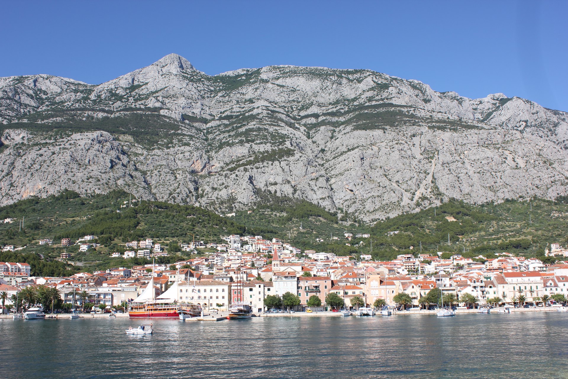
Makarska town beneath the Biokovo massif — the defining view of the Adriatic Highway’s most scenic section

ROUTE

Biokovo Coast Ride — Split to Ploče via Omiš and Makarska

The most spectacular Adriatic Highway section — the Cetina canyon at Omiš and a hundred kilometres under the Biokovo wall past the Makarska riviera.

scenic-road151 km3.5 hmoderate
DOWNLOAD GPX

<a rel="nofollow" class="external text" href="https://www.flickr.com/people/3314 / Wikimedia Commons / CC BY 2.0

ABOUT THIS ROUTE

The route in detail

Between Split and Ploče the Adriatic Highway performs its finest act: the road squeezes between Biokovo’s limestone wall and the sea, threading the Cetina canyon at Omiš and the fifteen villages of the Makarska riviera, each with its own pebble cove beneath the mountain.

South of Split the D8 crosses the Cetina at Omiš, where the river exits a canyon of 200-metre walls on its last kilometre to the sea — one short detour takes you into the gorge itself. From Omiš to Makarska the road plays hide-and-seek with the shoreline through tunels and short climbs, with Biokovo’s barren summits (up to 1,762 m at Sveti Jure, reachable by a side road) towering over the ride. Past Makarska the riviera continues through Brela’s pine-fringed coves to Ploče at the Neretva delta, where the landscape suddenly opens into marshland and citrus groves.
PLAN RESPONSIBLY

Season & safety

Seasonal conditions

Open year-round; best May to October. Summer mornings recommended — the riviera crawls with beach traffic after 10:00. Mountain side-roads to Biokovo (Sveti Jure) close in winter snow. Check HAK reports for conditions. Verified 2026-11-07 (Hrvatski autoklub / HAK traffic conditions).

Key hazards

  • Shared coastal road with local traffic, buses and cyclists in season.
  • Sharp bends, narrow sections and occasional gravel or debris after rain or wind.
  • Tunnels and rapid light changes on some sections — keep a clear visor and remove sunglasses.
  • Strong bura (NE) wind episodes under Velebit and on exposed channel sections, mostly in winter.

Required gear

  • Certified motorcycle helmet and full protective riding gear.
  • Working lights and a clear visor suitable for tunnels and changing visibility.
  • Waterproof outer layer, an additional warm layer and charged phone.
  • Basic puncture and roadside emergency equipment appropriate for the motorcycle.

Check before you go

  • Check the current HAK traffic report (hak.hr) for the route sections.
  • Check the forecast for wind (especially bura) and rain along the coast.
  • Confirm sufficient fuel range — services thin out on the more remote sections.
  • Plan the ride within daylight and identify safe rest stops before departure.

Local guidance

Treat the published duration as riding time only. Follow posted limits, maintain space from larger vehicles, remove dark sunglasses before tunnels and never stop inside a tunnel or on an active traffic lane.

WAYPOINTS

Route points

  1. 01

    Split

    start

  2. 02

    Omiš

    waypoint

  3. 03

    Makarska

    waypoint

  4. 04

    Brela — Baška voda corridor

    waypoint

  5. 05

    Ploče

    end

MAP & ROUTE

On the atlas

Elevation627 m high point0 m low point2,110 m total climbing14% steepest stretch (km 132.3)
627 m0 km145 km

INTERESTS

Why riders & travellers love it

WEATHER

Weather along the route

Forecast data from Open-Meteo. Updated regularly.

KEEP EXPLORING

The atlas continues

More routes, destinations and stories from every corner of the world — start where you like below.