Seasonal conditions
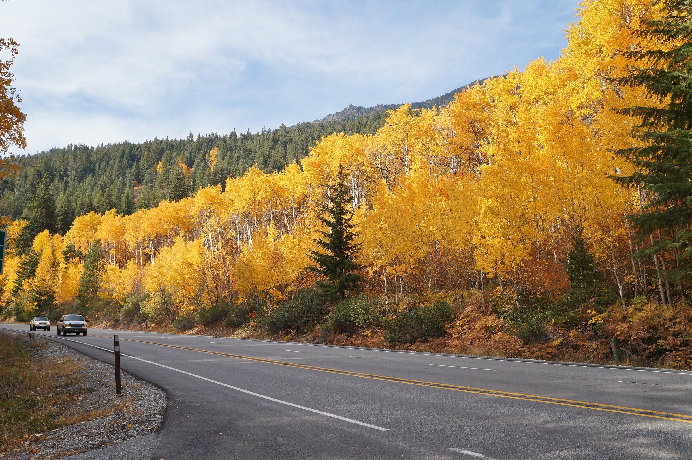
Pass runs May–October without chains reliably; Tumwater Canyon is spectacular in October color. Winter crossing requires chains and daylight.
ROUTE
The Cascade crossing on US-2: 83 km from Skykomish’s rail yards over the 1,238-metre summit and down Tumwater Canyon into Bavarian Leavenworth.
SounderBruce / Wikimedia Commons / CC BY-SA 4.0
ABOUT THIS ROUTE
US-2 crosses the Cascades the way railroads used to: steadily, theatrically, with a payoff at the top. From Skykomish the highway follows the Skykomish River’s rapids to the summit of Stevens Pass at 1,238 metres, ski runs and the Great Northern’s old snowsheds marking the crest. Then Tumwater Canyon drops away — a tight, roaring gorge of switchbacks and whitewater — before the valley opens into Wenatchee River orchard country and Bavarian-themed Leavenworth, where every ride should end with a beer garden. This is Washington’s essential mountain pass: one summit, one canyon, and two entirely different worlds on either side.
US-2 crosses the Cascades the way railroads used to: steadily, theatrically, with a payoff at the top. From Skykomish the highway follows the Skykomish River’s rapids to the summit of Stevens Pass at 1,238 metres, ski runs and the Great Northern’s old snowsheds marking the crest. Then Tumwater Canyon drops away — a tight, roaring gorge of switchbacks and whitewater — before the valley opens into Wenatchee River orchard country and Bavarian-themed Leavenworth, where every ride should end with a beer garden. This is Washington’s essential mountain pass: one summit, one canyon, and two entirely different worlds on either side.
PLAN RESPONSIBLY
Pass runs May–October without chains reliably; Tumwater Canyon is spectacular in October color. Winter crossing requires chains and daylight.
WAYPOINTS
Stevens Pass summit, 1,238 m
waypoint
MAP & ROUTE
INTERESTS
WEATHER
Forecast data from Open-Meteo. Updated regularly.
REGIONS
KEEP EXPLORING
More routes, destinations and stories from every corner of the world — start where you like below.


