Seasonal conditions
March–November; October is harvest and the quietest. Avoid Palmanova Saturday market midday crowds. Verified 2026-11-09.
ROUTE
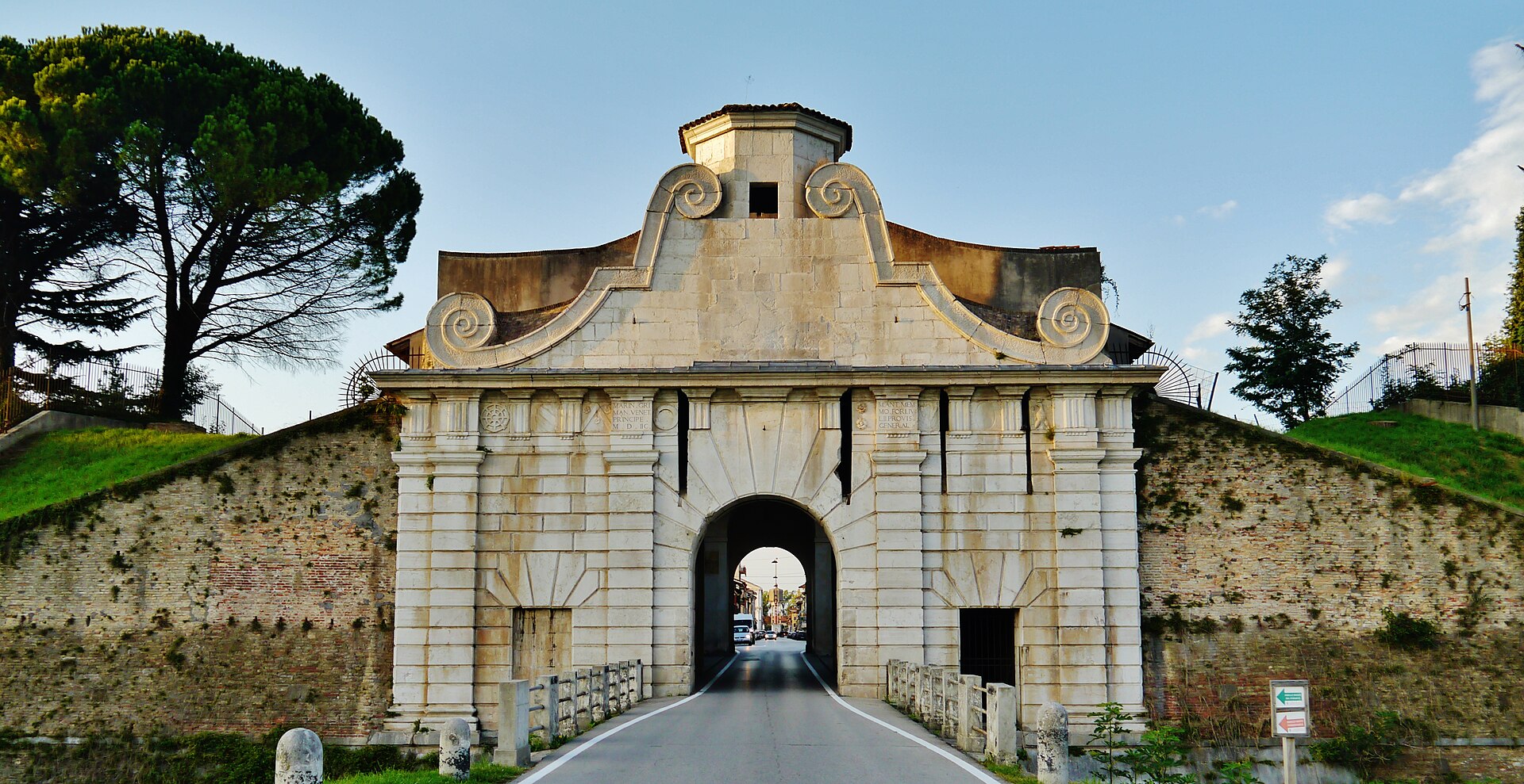
A flat, fast loop that strings three UNESCO stars together: Roman Aquileia, Venice’s nine-pointed star fortress at Palmanova and Lombard Cividale over the Natisone gorge.
Zairon / Wikimedia Commons / CC BY-SA 4.0
ABOUT THIS ROUTE
This is Friuli’s history ride: dead-flat roads through the Isonzo plain, a fortress you can only understand from its ramparts, and a Lombard capital over a jade-green gorge. Aquileia’s Roman ruins and basilica mosaics open the loop; the straight plain roads then run to Palmanova, where you can ride around the outer star ring and walk the gates; Cividale closes it with the Tempietto Longobardo and the Devil’s Bridge. Around 45 kilometres each way between stops, no pass, no gravel, no rush — the ride for a rest day between alpine passes.
From Aquileia the SR352 runs north with the campanile behind you; branch onto the old plain roads through Terzo di Aquileia for the quietest lines. Palmanova’s ring roads let you circle the star — ride the outer lunette road for the full shape, then park for the gates and piazza. North from Palmanova the road narrows through villages to San Giovanni al Natisone and drops into Cividale from the wine-hill side. Return via the SS54 along the Natisone valley or retrace. The whole loop rides well on any bike; surface is good asphalt the whole way, traffic light except around Palmanova’s market mornings.
PLAN RESPONSIBLY
March–November; October is harvest and the quietest. Avoid Palmanova Saturday market midday crowds. Verified 2026-11-09.
WAYPOINTS
Aquileia
start
Palmanova
waypoint
Cividale del Friuli
end
MAP & ROUTE
DESTINATIONS

A ruined Roman imperial city with one of the largest early-Christian mosaic floors in Europe.
Friuli-Venezia Giulia

The nine-pointed star city — a utopian fortress of 1593 built from scratch by Venice, intact behind three rings of walls, a UNESCO World Heritage Site you can walk in an hour.
Friuli-Venezia Giulia

The first Lombard capital of Italy — a UNESCO town of golden stuccoes and a Devil’s Bridge over the emerald Natisone, twenty minutes from Udine on the Slovene border.
Friuli-Venezia Giulia
INTERESTS
WEATHER
Forecast data from Open-Meteo. Updated regularly.
NEARBY
REGIONS
KEEP EXPLORING
More routes, destinations and stories from every corner of the world — start where you like below.

