Seasonal conditions
Stable, snow-free mountain conditions; typically late spring to early autumn.
ROUTE
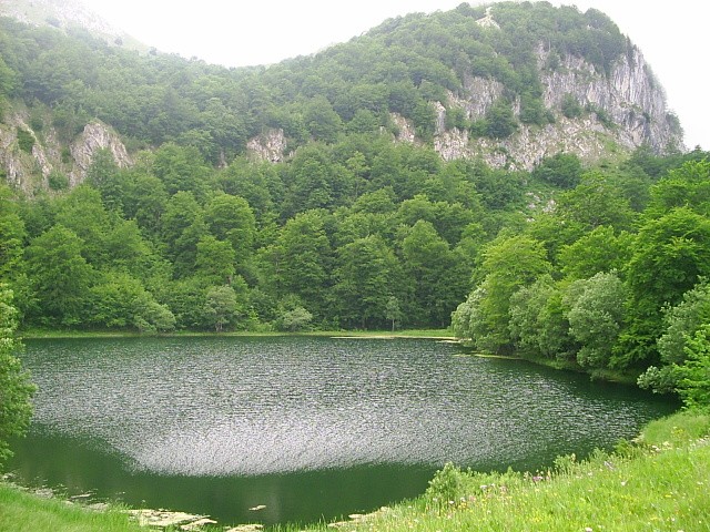
A challenging highland loop in Sutjeska National Park from the Donje Bare area on Zelengora toward a viewpoint over Maglić, the highest peak in Bosnia & Herzegovina, and back.
Martin Brož / Wikimedia Commons / CC BY 3.0
ABOUT THIS ROUTE
The Donje Bare and Maglić View Loop is a challenging mountain walking day in Sutjeska National Park, on the Zelengora highland. It begins and ends at the Donje Bare area, one of the glacial mountain lakes of Zelengora, and climbs toward a viewpoint over Maglić — at 2,386 metres the highest peak in Bosnia & Herzegovina — before returning across the highland. The route pairs the quiet of the Zelengora lakes with the grandeur of the Maglić view, and it is a serious full mountain day rather than a short pasture walk: a long distance with substantial ascent on remote high ground. The technical rating is moderate, but the physical demand is high, and the route is at its best only under stable snow-free conditions.
The loop sets out from the Donje Bare area on the Zelengora highland, one of the glacial mountain lakes that give the massif its character, and climbs across open high ground toward a viewpoint over Maglić, the highest peak in Bosnia & Herzegovina. The view from the high ground takes in the summit of Maglić and the wild country of the park, including the direction of the Perućica primeval forest, without entering it. The return follows the established highland ground back to the Donje Bare starting area, closing the circuit. The day is a challenging undertaking: a long distance, substantial ascent, remote and exposed high ground, and terrain that changes sharply with the weather. The stated duration is typical rather than guaranteed, and the high ground is not accessible or safe in all seasons.
PLAN RESPONSIBLY
Stable, snow-free mountain conditions; typically late spring to early autumn.
This is a challenging remote mountain day on exposed high ground. Inexperienced visitors should use current local guidance or a qualified mountain guide. The route reaches a viewpoint over Maglić; it does not ascend the summit, and no summit attempt should be made without specific preparation and conditions.
MAP & ROUTE
INTERESTS
WEATHER
Forecast data from Open-Meteo. Updated regularly.
NEARBY
REGIONS
KEEP EXPLORING
More routes, destinations and stories from every corner of the world — start where you like below.