Seasonal conditions
Stable, snow-free conditions; typically late spring to early autumn.
ROUTE
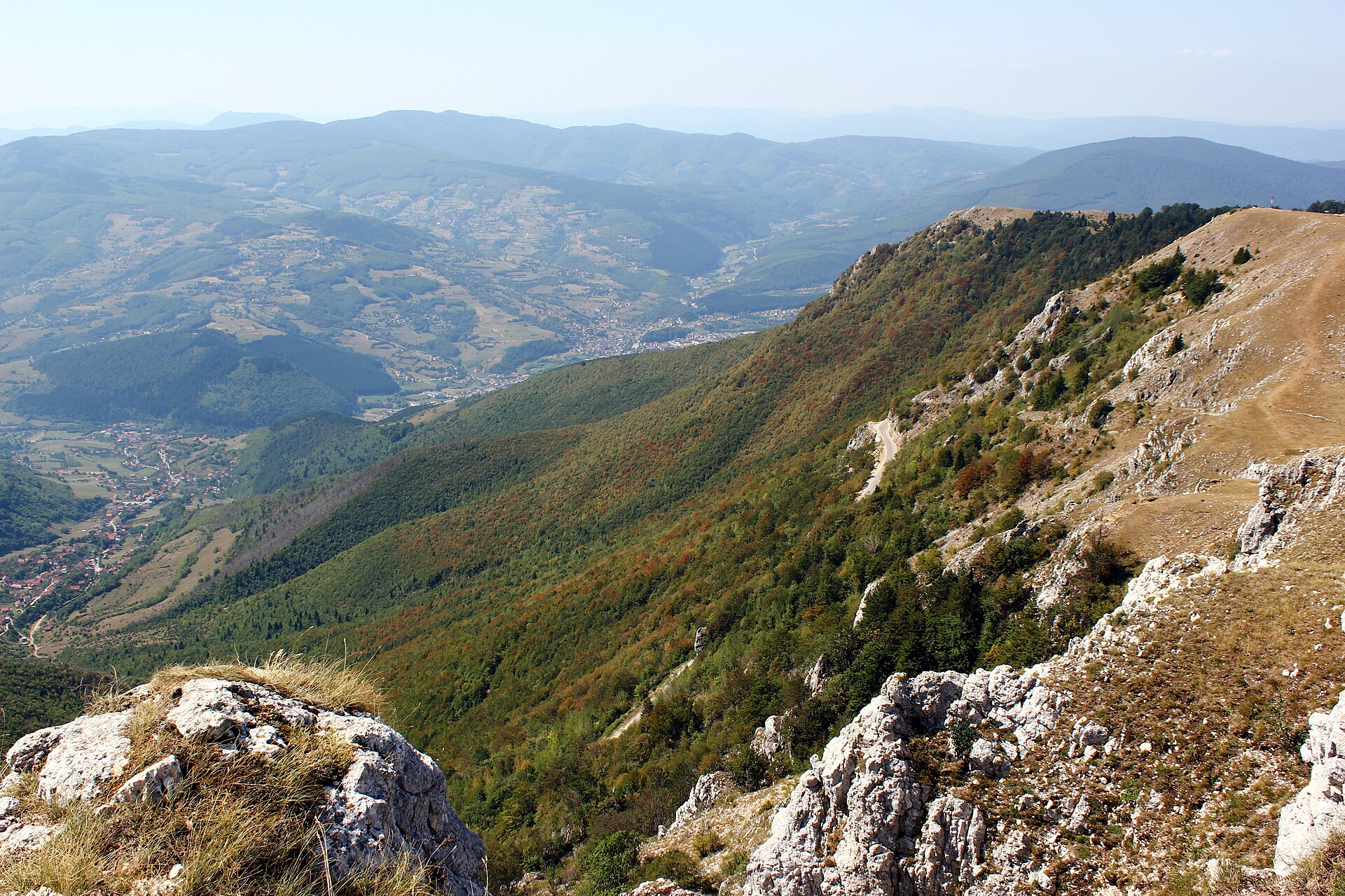
A moderate high-pasture loop on the Vlašić massif from the Galica area over the Devečani ground to the Paljenik (Opaljenik) peak area and back, with long views across central Bosnia.
Julian Nyča / Wikimedia Commons / CC BY-SA 4.0
ABOUT THIS ROUTE
The Galica–Devečani–Paljenik Loop is a moderate mountain walking day on the Vlašić massif above Travnik, the broad central-Bosnian mountain of pastures and peaks. It begins and ends at the Galica area, crosses the Devečani high ground and climbs to the Paljenik (Opaljenik) peak area — the higher summit ground of the massif — before returning by the same established highland ground. It is a recognised mountain route rather than a casual valley stroll: a shorter loop than the full Vlašić traverses, but one that still reaches high ground near 1,900 metres and earns its panorama with steady climbing. The route is at its best under stable snow-free conditions, when the pastures are green and the high ground is clear; outside that window the summit area can be unsuitable and the route demands current local judgement.
The loop sets out from the Galica area on the highland of the Vlašić massif and climbs toward the Devečani ground — the open high pasture that leads toward the summit country of the mountain. From there the route continues to the Paljenik (Opaljenik) peak area, the higher summit ground of the massif at roughly 1,918 metres, where the view opens across central Bosnia toward the mountains of the Lašva and Vrbas valleys. The return follows the same established highland ground back to the Galica starting area, closing the circuit. The day is a moderate mountain undertaking: steady climbing, open and exposed high ground, and terrain that changes with the weather. The stated duration is typical rather than guaranteed, and the high ground is not accessible or safe in all seasons.
PLAN RESPONSIBLY
Stable, snow-free conditions; typically late spring to early autumn.
The route is not technically demanding but it reaches high ground near 1,900 metres and remains a mountain day. Visitors without mountain-navigation experience should use current local guidance or a qualified guide, and should not attempt the summit area in snow or ice without appropriate winter skills and equipment.
WAYPOINTS
Galica trailhead
start
Paljenik (Opaljenik) Peak
waypoint
Galica trailhead
end
MAP & ROUTE
INTERESTS
WEATHER
Forecast data from Open-Meteo. Updated regularly.
TRAVEL GUIDES
NEARBY
REGIONS
KEEP EXPLORING
More routes, destinations and stories from every corner of the world — start where you like below.


