destination360.orgPLACES / PEOPLE / STORIES
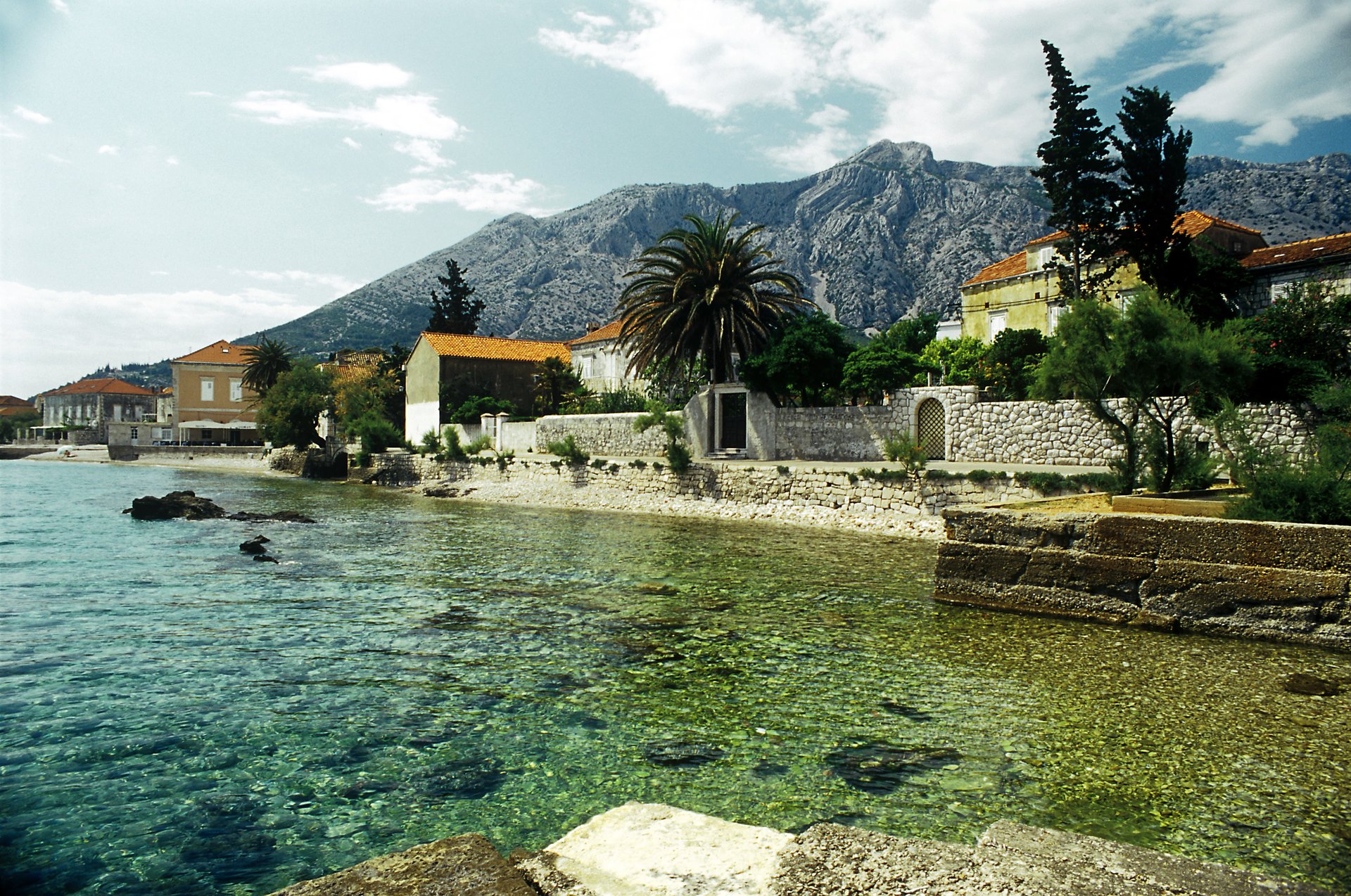
The Orebić seafront under Mount Sv. Ilija — the finish of the Pelješac peninsula ride facing Korčula

ROUTE

Pelješac Peninsula Ride — Ston to Orebić

A wine-country crossing of the Pelješac peninsula — Dingač vineyard terraces above the sea, oyster bays at Mali Ston and the island views over to Korčula at Orebić.

scenic-road57 km1.5 heasy
DOWNLOAD GPX

Falk2 / Wikimedia Commons / CC BY-SA 4.0

ABOUT THIS ROUTE

The route in detail

Pelješac is Croatia’s riding escape from the Dubrovnik crowds: a narrow mountain-backed peninsula where the road threads between dry-stone vineyard walls and the sea, past oyster farms, up over the famous Dingač plateau and down to Orebić facing Korčula.

Starting beneath the Ston walls — Europe’s longest medieval fortification — the ride follows the Pelješac channel north-west past the oyster beds of Mali Ston bay, then climbs the peninsula’s spine through Platy vineyards. The signature moment is the descent to Dingač and Potomje, where the vineyard terraces drop almost vertically to the sea on stone-supported plots. At Orebić the road ends at the seafront facing Korčula island, with ferry connections for the onward hop. The peninsula’s single main road keeps traffic light even in August.
PLAN RESPONSIBLY

Season & safety

Seasonal conditions

Open year-round; best April to October. Harvest season (September-October) brings wine-village weekend traffic. The exposed channel sections gust in bura wind episodes — check HAK reports in winter. Verified 2026-11-07 (Hrvatski autoklub / HAK traffic conditions).

Key hazards

  • Shared coastal road with local traffic, buses and cyclists in season.
  • Sharp bends, narrow sections and occasional gravel or debris after rain or wind.
  • Tunnels and rapid light changes on some sections — keep a clear visor and remove sunglasses.
  • Strong bura (NE) wind episodes under Velebit and on exposed channel sections, mostly in winter.

Required gear

  • Certified motorcycle helmet and full protective riding gear.
  • Working lights and a clear visor suitable for tunnels and changing visibility.
  • Waterproof outer layer, an additional warm layer and charged phone.
  • Basic puncture and roadside emergency equipment appropriate for the motorcycle.

Check before you go

  • Check the current HAK traffic report (hak.hr) for the route sections.
  • Check the forecast for wind (especially bura) and rain along the coast.
  • Confirm sufficient fuel range — services thin out on the more remote sections.
  • Plan the ride within daylight and identify safe rest stops before departure.

Local guidance

Treat the published duration as riding time only. Follow posted limits, maintain space from larger vehicles, remove dark sunglasses before tunnels and never stop inside a tunnel or on an active traffic lane.

WAYPOINTS

Route points

  1. 01

    Ston

    start

  2. 02

    Janjina — peninsula spine

    waypoint

  3. 03

    Dingač — Potomje vineyards

    waypoint

  4. 04

    Orebić

    end

MAP & ROUTE

On the atlas

Elevation410 m high point0 m low point1,177 m total climbing23% steepest stretch (km 33.2)
410 m0 km56 km

INTERESTS

Why riders & travellers love it

WEATHER

Weather along the route

Forecast data from Open-Meteo. Updated regularly.

KEEP EXPLORING

The atlas continues

More routes, destinations and stories from every corner of the world — start where you like below.