
Fortress & Viewpoint
Yellow Fortress & Vratnik Viewpoint
Sarajevo · Sarajevo & Olympic Mountains
QUICK INFORMATION
- CATEGORY
- Fortress & Viewpoint
- COUNTRY
- Bosnia & Herzegovina
- REGION
- Sarajevo · Sarajevo & Olympic Mountains
- DURATION
- 1–2 days
ABOUT THIS ATTRACTION
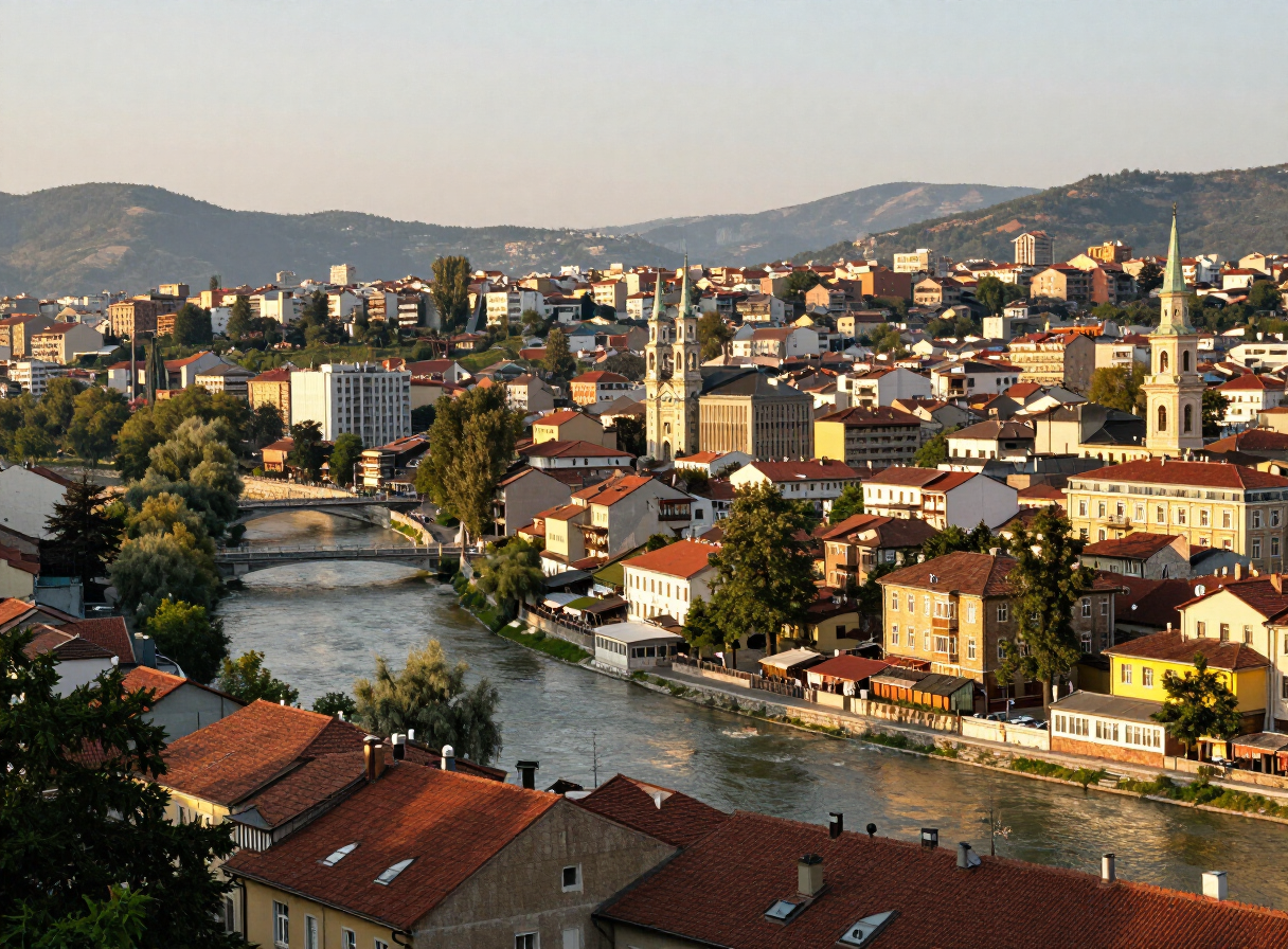
The Yellow Fortress, known in Sarajevo as Žuta tabija, is one of the historic fortifications that crown the Vratnik old town above the Miljacka. It stands on the heights east of the city centre and offers one of the broadest panoramic views over Sarajevo — the whole east-west valley, the river, the minarets of the old town and the mountains closing the skyline at either end. The walk uphill from Baščaršija is short but steep, and the fortress is a favourite place to look down on the city in the late afternoon. It is part of the wider defensive landscape of Vratnik rather than a single standalone monument, and it is best understood as one viewpoint within that historic fortified quarter.
HISTORY & BACKGROUND
The story behind it
Žuta tabija is part of the Vratnik fortified old town, the defensive quarter laid out on the heights above Sarajevo’s old bazaar. The fortifications of Vratisk were developed largely in the 18th century, when the Ottoman authorities built and reinforced a ring of bastions, gates and walls to protect the city from the surrounding hills. The Yellow Fortress took its present form within that 18th-century programme, and it survives as one of the most accessible of the Vratnik bastions. The walls and viewpoints have been maintained as a public landmark, and the fortress is now valued as much for the panorama it offers as for its military history.
WHAT TO SEE
What to see here
The panoramic view from the fortress — the clearest single overview of Sarajevo’s east-west valley, the Miljacka, the old town and the surrounding mountains.
The bastion itself — the surviving stone walls of Žuta tabija, read as part of the 18th-century Vratnik fortifications rather than an isolated tower.
The walk up through Vratnik — the steep approach from the old town passes through the historic fortified quarter, with its gates, walls and old houses.
The wider Vratnik defensive landscape — the neighbouring bastions and walls that together formed the city’s upper defences.
WHY IT MATTERS
Why it matters
The Yellow Fortress is the easiest of Sarajevo’s hilltop viewpoints to reach from the old town, and the panorama it gives is one of the best ways to understand the city’s geography at a glance — a narrow valley stretched along a river between mountains. As part of the Vratnik fortifications it also opens the upper, defensive layer of Ottoman Sarajevo that lies above the bazaar. For a visitor it is a short, rewarding climb that turns the city below into a single picture.
PRACTICAL INFORMATION
Before you go
THROUGH THE LENS
From the road

MAP & LOCATION
Yellow Fortress & Vratnik Viewpoint
Yellow Fortress & Vratnik Viewpoint, Sarajevo, Sarajevo & Olympic Mountains, Bosnia & Herzegovina
43.8614, 18.4377
MORE ATTRACTIONS
More to see in Sarajevo


FOOD & DRINK
Where to eat nearby
Željo — the city’s most famous ćevapi, no-frills and perfect
Dveri — cosy cellar restaurant with modern Bosnian plates
Inat Kuća — traditional dishes in the defiant “House of Spite”
HOTELS & STAYS
Where to stay nearby
Hotel Europe — the grande dame, open since 1882
Isa Begov Hamam Hotel — Ottoman charm beside the river
Hostel Franz Ferdinand — stylish budget base in the centre
ITINERARIES
Day-by-day routes


INTERESTS
Explore by what you love
ROUTES
Routes through here
Mostar to Sarajevo via the Neretva Canyon
A classic Balkan ride north up the Neretva canyon — river, cliffs and forest from Mostar to Sarajevo.
130 km · 3 h · moderate
VIEW ROUTEBoračko Lake Ride — Sarajevo to Boračko Jezero via Konjic
A short Herzegovina escape: from Sarajevo over the Tarčin plateau to Konjic, then up the wooded Borač valley to the glacial green amphitheatre of Boračko jezero below Prenj.
82 km
VIEW ROUTETrebević Summit from Pogledine
An out-and-back ascent from Pogledine past Trebević’s Olympic bobsleigh track and forest paths to the Sofe summit area above Sarajevo.
16 km · 5.8 h · moderate
VIEW ROUTESkakavac Waterfall Loop
A forest loop from the Skakavac protected-area entrance to the viewpoint and foot of Sarajevo’s 98-metre waterfall.
9 km · 3.9 h · moderate
VIEW ROUTEPART OF
Keep exploring
The atlas goes on — more attractions, destinations and stories from every corner of the world.