Seasonal conditions
Open year-round; spring blossoms (April) and harvest (September) are the best windows. Verified 2026-11-07 (AMSS road conditions).
ROUTE
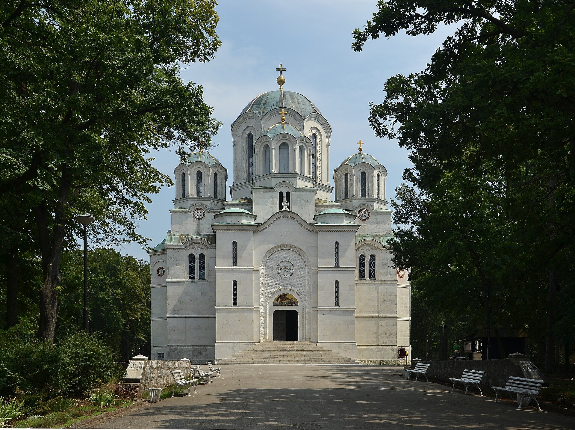
Šumadija's royal road — from Belgrade through the orchards of the Morava country to Oplenac, the Karađorđević mausoleum at Topola, Gornji Milanovac and the spa town of Vrnjačka Banja.
Pudelek / Wikimedia Commons / CC BY-SA 3.0
ABOUT THIS ROUTE
This is Serbia's heartland ride: the rolling hills of Šumadija between the Sava and the West Morava, the region of plum orchards and royal history. The route runs from Belgrade down the old Belgrade–Kragujevac corridor to Topola — where the Church of St George crowns Oplenac hill as the mausoleum of the Karađorđević dynasty — through Gornji Milanovac's Takovo woods, and finishes in Vrnjačka Banja, Serbia's most storied spa town.
South out of Belgrade the road climbs through Avala's foothills and settles into the orchard country of central Šumadija. Topola sits at the heart of the region's history — the First Serbian Uprising began here in 1804, and the white marble Church of St George (built 1910–1912) on Oplenac hill holds the dynasty's tombs under mosaics of epic scale. The road west through Gornji Milanovac runs the Takovo woods where the Second Uprising was raised, then follows the upper Despotovac and Morava valleys to Vrnjačka Banja, whose seven mineral springs made it the 'Queen of Serbian spas' in the 19th century. The whole route is relaxed riding — wide bends, moderate traffic, and the most food stops per kilometre of any Serbian ride.
PLAN RESPONSIBLY
Open year-round; spring blossoms (April) and harvest (September) are the best windows. Verified 2026-11-07 (AMSS road conditions).
Treat the published duration as riding time only. Follow posted limits, maintain space from larger vehicles, remove dark sunglasses before tunnels and never stop inside a tunnel or on an active traffic lane.
WAYPOINTS
Belgrade
start
Topola — Oplenac
waypoint
Gornji Milanovac
waypoint
Vrnjačka Banja
end
MAP & ROUTE
DESTINATIONS

A Danube–Sava capital of fortresses, boulevards and café culture — the white city at the confluence.
Belgrade

The birthplace of modern Serbia — Karađorđe’s hill town and the mosaic mausoleum of the Karađorđević dynasty on Oplenac.
Šumadija & Western Serbia

The Takovo town in the Rudnik foothills — where the Second Uprising began, wrapped in the cleanest air in Šumadija.
Šumadija & Western Serbia

The “queen of Serbian spas” — seven mineral springs, the belle-époque park and the Bridge of Love, below Mount Goč.
Šumadija & Western Serbia
INTERESTS
WEATHER
Forecast data from Open-Meteo. Updated regularly.
REGIONS
KEEP EXPLORING
More routes, destinations and stories from every corner of the world — start where you like below.


