Seasonal conditions
Best May–October; the plateau sits over 1,000 m and winters bring snow and ice — check AMSS reports in the cold months. Verified 2026-11-07 (AMSS road conditions; Srbijavoz Šargan Eight schedule records).
ROUTE
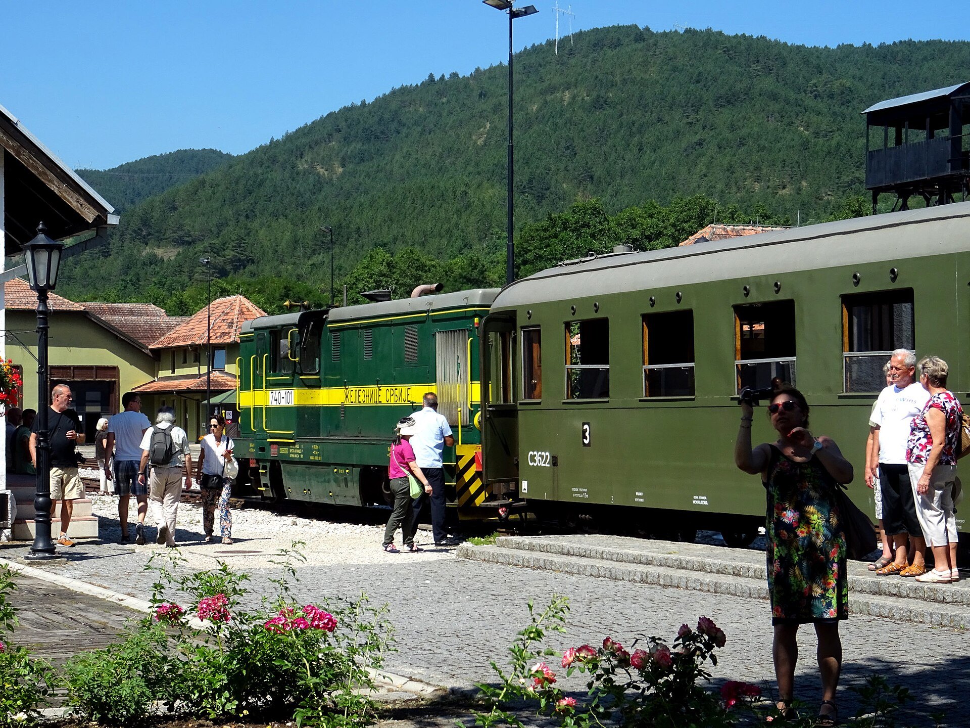
The Zlatibor highland loop — Užice's hydro dam country, the Šargan Eight at Mokra Gora, the Zlatibor plateau pastures and the open-air museum of Sirogojno, back over Zlatibor's beech ridges.
Whitepixels / Wikimedia Commons / CC0
ABOUT THIS ROUTE
Western Serbia's highlands at their densest: this loop from Užice climbs the Drina country to Mokra Gora where the Šargan Eight heritage railway winds its figure-of-eight up 300 metres to the Šargan Vitasi pass, crosses the Zlatibor plateau — Serbia's most famous mountain resort region — and returns through Sirogojno's open-air museum village over the beech ridges of Zlatibor.
From Užice the road follows the Đetinja gorge upstream through hydro country towards Mokra Gora, the tiny station town where the Šargan Eight narrow-gauge railway (built 1921–1925) begins its famous climb — even seeing the rails cross over themselves is worth the detour, and the ride to Šargan Vitasi station parallels the train's loop. The road then crosses the Zlatibor plateau's high pastures — pine woods, cattle country and Serbia's best-known mountain resort — before dropping into Sirogojno, the village museum of preserved 19th-century log houses, and climbing back over the ridges to Užice. Every leg is bend-heavy and well-surfaced; watch for livestock on the plateau and the queue of visitor cars near Mokra Gora in season.
PLAN RESPONSIBLY
Best May–October; the plateau sits over 1,000 m and winters bring snow and ice — check AMSS reports in the cold months. Verified 2026-11-07 (AMSS road conditions; Srbijavoz Šargan Eight schedule records).
Treat the published duration as riding time only. Follow posted limits, maintain space from larger vehicles, remove dark sunglasses before tunnels and never stop inside a tunnel or on an active traffic lane.
WAYPOINTS
Užice
start
Mokra Gora — Šargan Eight
waypoint
Zlatibor
waypoint
Sirogojno
waypoint
Užice
end
MAP & ROUTE
DESTINATIONS

The fortress town on the Đetinja — a 14th-century citadel, the first hydro plant in Serbia, and the Partisan republic of 1941.
Šumadija & Western Serbia

The Šargan Eight — Europe’s most scenic narrow-gauge railway — and Kusturica’s wooden Drvengrad, in the green fold between Tara and Zlatibor.
Šumadija & Western Serbia

The golden-pine highland air spa — a century of mountain tourism, and the gateway to Šargan, Drvengrad and Tara.
Šumadija & Western Serbia
INTERESTS
WEATHER
Forecast data from Open-Meteo. Updated regularly.
REGIONS
KEEP EXPLORING
More routes, destinations and stories from every corner of the world — start where you like below.


