Seasonal conditions
Rideable year-round; best March–June and September–November. Verified 2026-11-07.
ROUTE
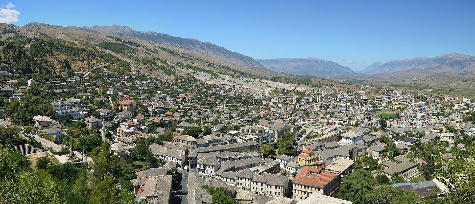
Ride south through the Vjosa and Drinos valleys from Berat to Gjirokastër, the stone city under its castle — two UNESCO towns in one day on quiet inland roads.
Pudelek (Marcin Szala) / Wikimedia Commons / CC BY-SA 3.0
ABOUT THIS ROUTE
The inland road between Albania\u2019s two UNESCO old towns is a quiet, satisfying ride: the wide Vjosa valley, the new bridge over one of Europe\u2019s last wild rivers, and the Drinos plain before Gjirokastër\u2019s stone roofs rise under its fortress.
Leaving Berat the road follows the Osum south to its confluence with the Vjosa, then the SH4 down the wide Vjosa valley past Fier-Skeptic turn-offs to Tepelenë, where the Drinos joins. Beyond Tepelenë the valley narrows into low rocky hills and opens again into the Drinos plain, with Gjirokastér appearing at the end as a slope of grey stone roofs below its dramatic castle. Gjirokastér\u2019s old town — UNESCO-listed like Berat — preserves Ottoman-era tower houses (kulla) with slate roofs; the castle holds a Cold-War-era aircraft and the Ismail Kadare house museum.
PLAN RESPONSIBLY
Rideable year-round; best March–June and September–November. Verified 2026-11-07.
Treat the published duration as riding time only. Follow posted limits, maintain space from larger vehicles, remove dark sunglasses before tunnels and never stop inside a tunnel or on an active traffic lane.
WAYPOINTS
Berat
start
Tepelenë
waypoint
Gjirokastër
end
MAP & ROUTE
DESTINATIONS

The “city of a thousand windows” — a UNESCO-listed Ottoman town of white houses stacked up the hill beneath a living castle, with the Osum canyon’s rafting water an hour upriver.
South Inland

The “city of stone” — a UNESCO-listed Ottoman town of slate-roofed tower houses below its castle, with the Drino valley and cold-water springs of Blue Eye country at the door.
South Inland
INTERESTS
WEATHER
Forecast data from Open-Meteo. Updated regularly.
REGIONS
KEEP EXPLORING
More routes, destinations and stories from every corner of the world — start where you like below.


